Some of the best hikes in Iceland are right on Reykjavík’s doorstep. You don’t need to drive for hours or plan a multi-day expedition to reach serious Icelandic wilderness. Within a one-hour radius from the capital, you’ll find volcanic terrain still cooling from recent eruptions, geothermal valleys where rivers run warm, and one of the tallest waterfalls in the country hidden inside a fjord most people drive past without stopping.
We’ve hiked all of these trails dozens of times — with clients, with friends, and on our own — and they never get old. Each offers something completely different, from an easy educational stroll to a full-day challenge involving river crossings and cliff-edge paths.
Here are the five best hikes near Reykjavík, ranked by scenery, experience, and that particular feeling of “I can’t believe this exists so close to the city.”
One important note: conditions change fast in Iceland. Always check weather and trail conditions before heading out, bring layers, and wear proper hiking boots — not sneakers.
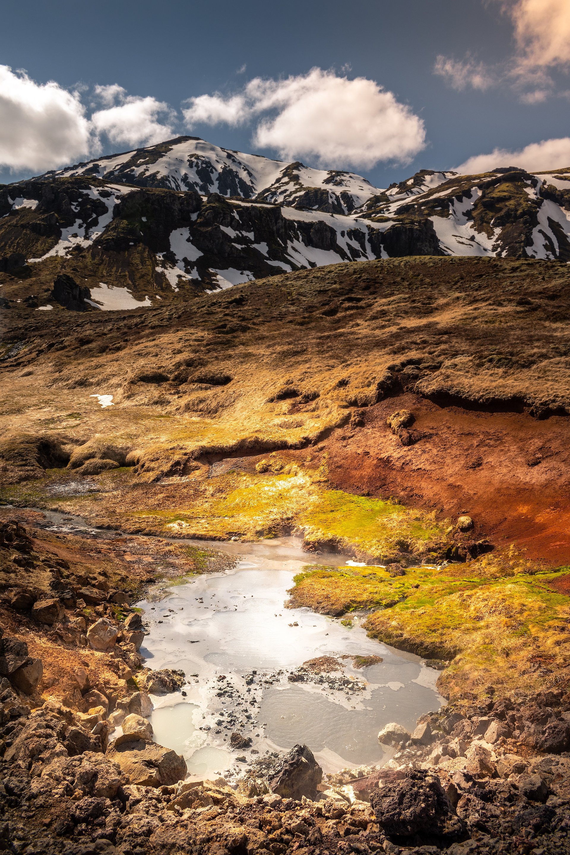
#5 — Mount Esja: Reykjavík’s Backyard Mountain
Location: ~25 km northeast of Reykjavík (20-minute drive) Trail length: ~7 km round trip (to Þverfellshorn) Elevation gain: ~600 m Difficulty: Moderate (challenging if you go for the summit) Time: 3–4 hours Season: Summer and Spring
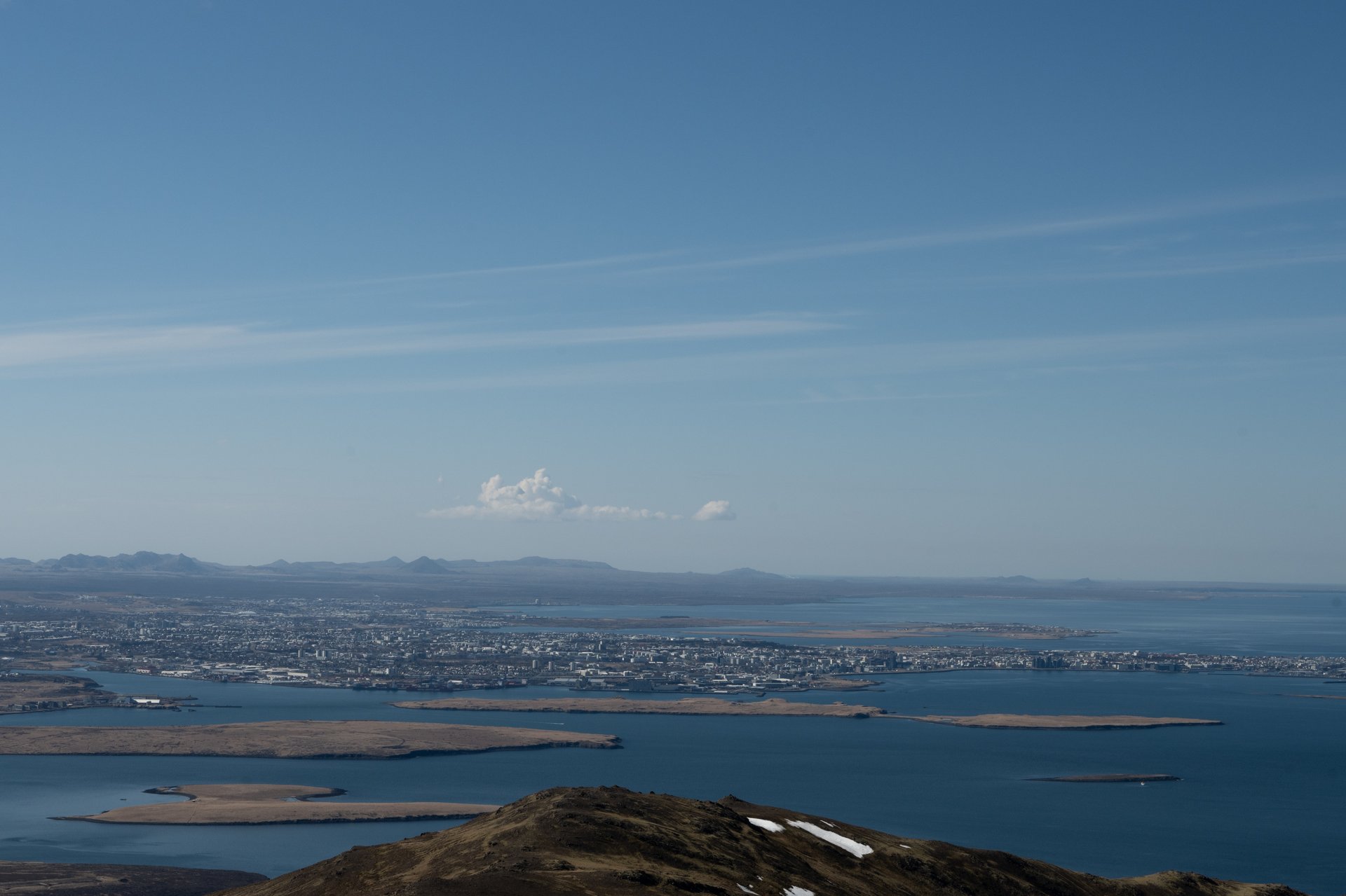
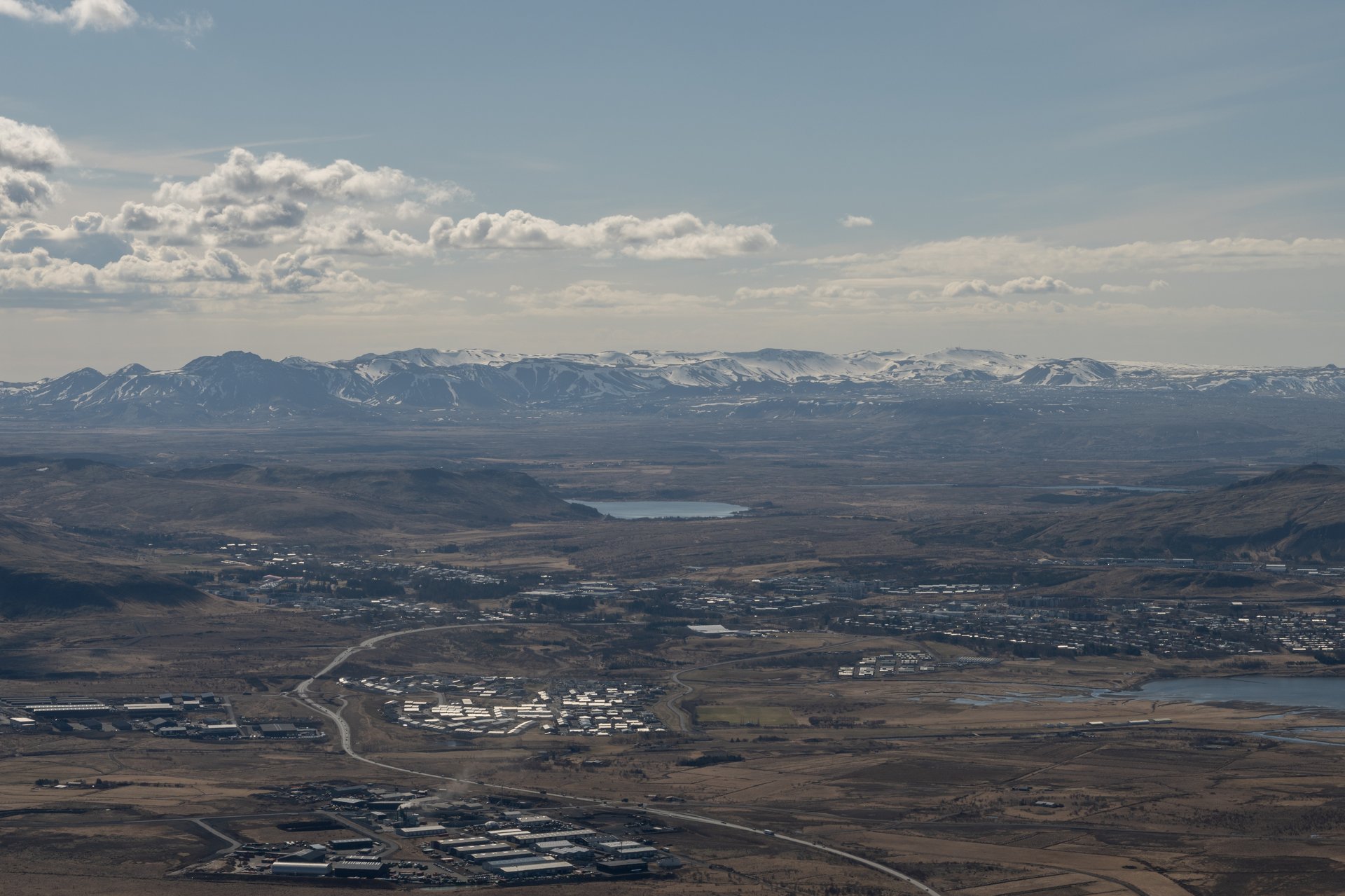
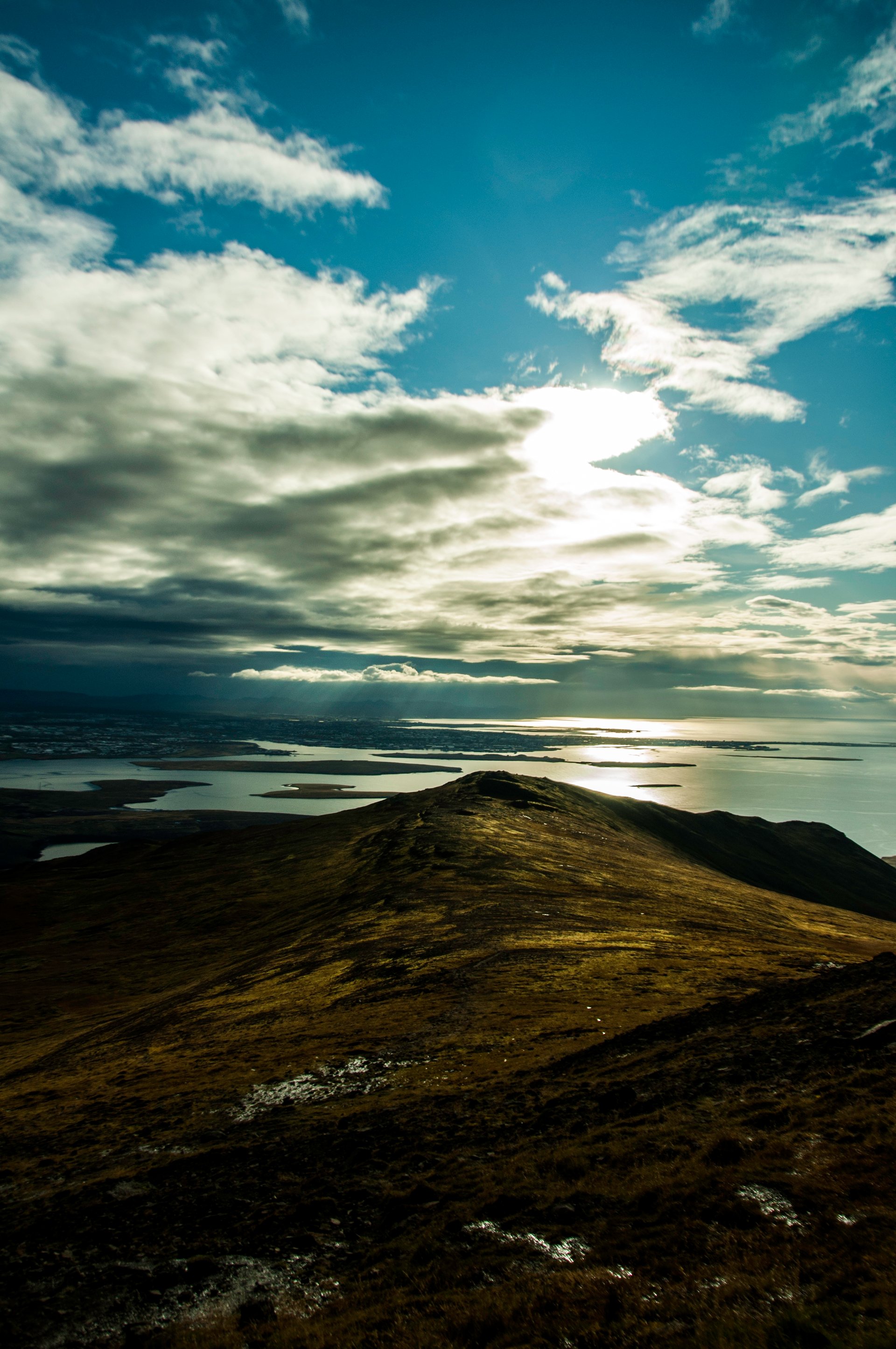
Every Reykjavík local has a relationship with Esja. It’s the flat-topped ridge dominating the northern skyline — visible from every window in the city. Most locals have hiked it at least once. Many do it weekly.
The standard route starts at the Esjustofa hiking center, where there’s parking and a small cafe. The trail winds upward through grassy slopes before transitioning into rockier terrain. It’s well-marked, and for the first two-thirds, it’s a straightforward moderate hike.
The final section separates casual hikers from the committed. Most people will stop at Steinn (Means Rock) but the push to the Þverfellshorn summit involves steeper, rockier ground and can feel exposed in wind. A chain section near the top helps with the last scramble. On a clear day, the reward is a panoramic view over the entire Reykjavík area, with the ocean on one side and highland mountains stretching out behind you.
Esja is the perfect “first hike” in Iceland. Accessible, solid trail infrastructure, and a genuine sense of accomplishment without requiring technical experience. But don’t underestimate it — weather changes quickly on the ridge, and the wind at the top can be fierce.
Insider tip: Start early. By mid-morning on summer weekends, the parking lot fills up. Arrive by 8 AM and you’ll have the trail mostly to yourself. In winter, when the mountain is covered in snow, there is a serious risk of avalanches.
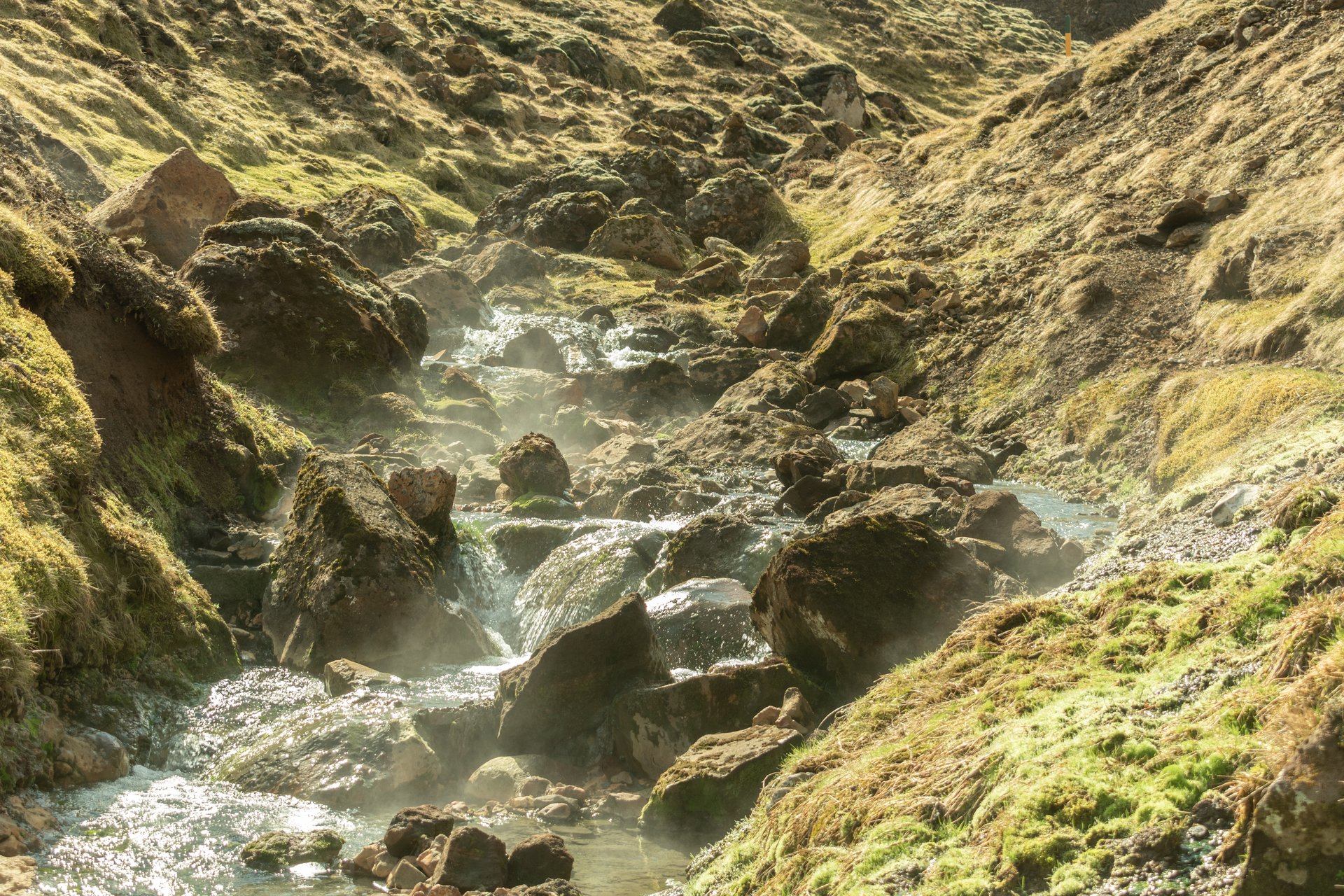
#4 — Reykjadalur Hot Spring River: Hike to Your Own Hot Bath
Location: Near Hveragerði, ~45 km southeast of Reykjavík (40-minute drive) Trail length: ~7 km round trip Elevation gain: ~250 m Difficulty: Easy to moderate Time: 2.5–3.5 hours (including bathing time) Season: Year-round (best October, bring crampons in winter or avoid it altogether)
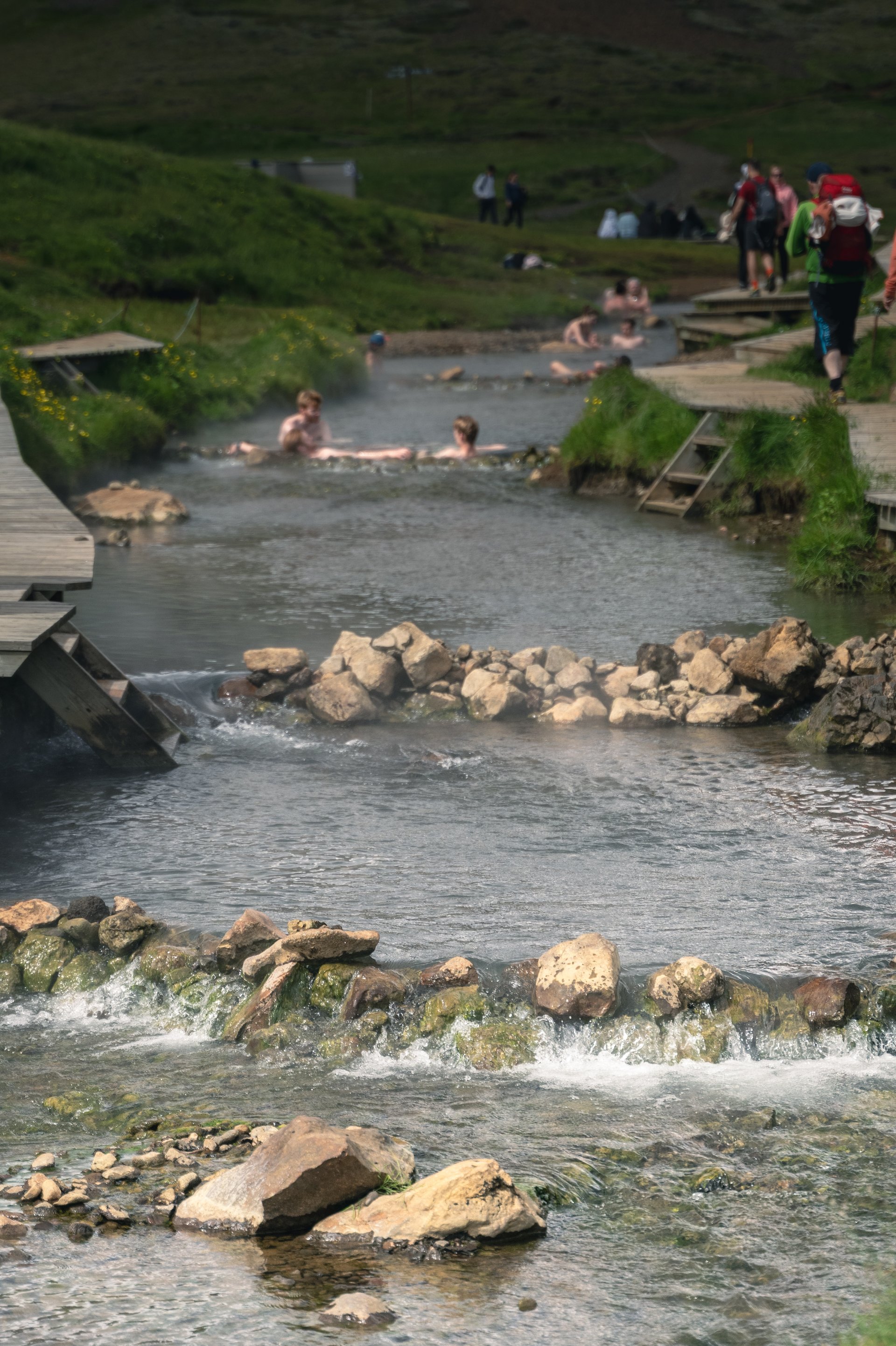
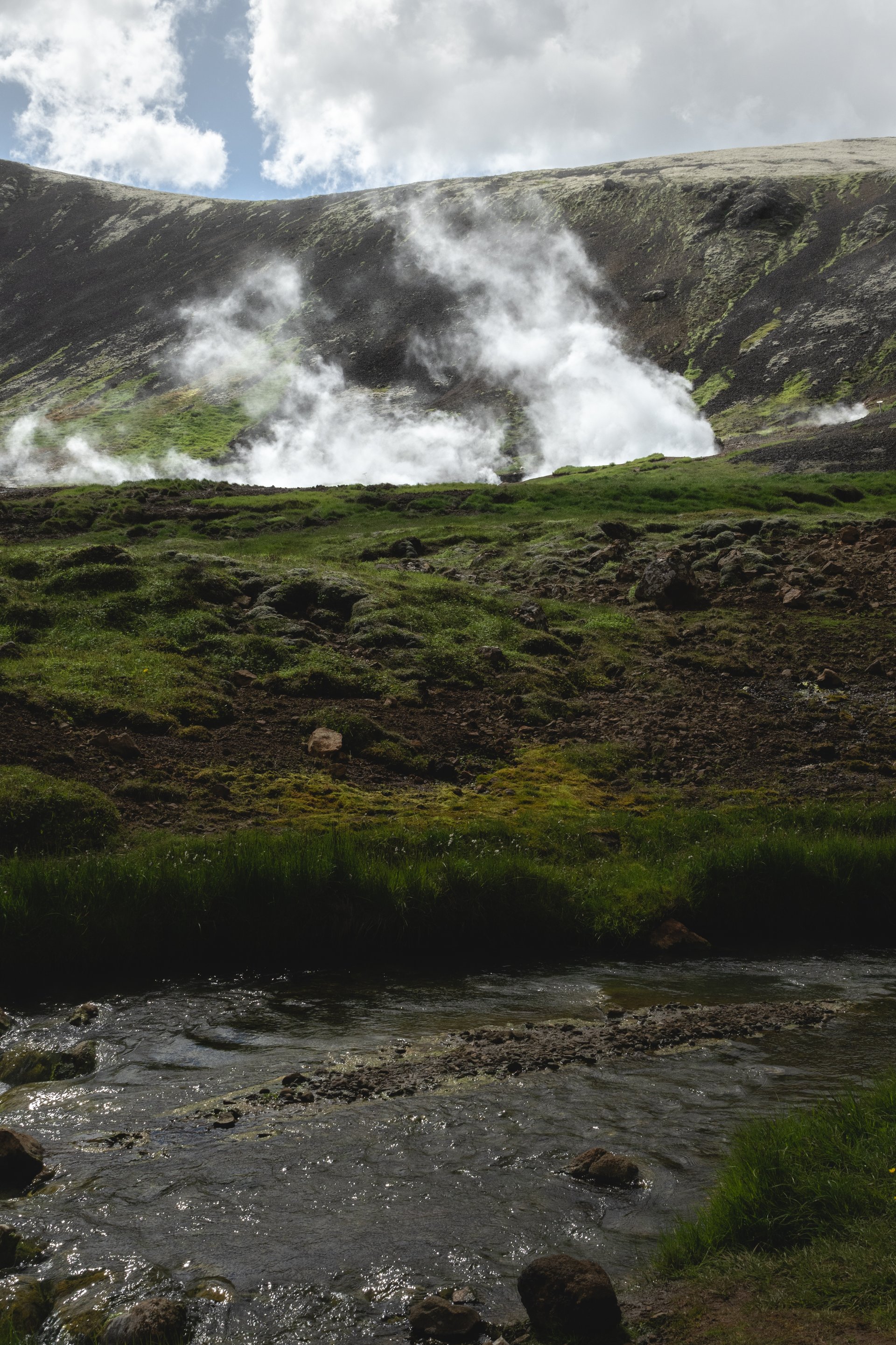
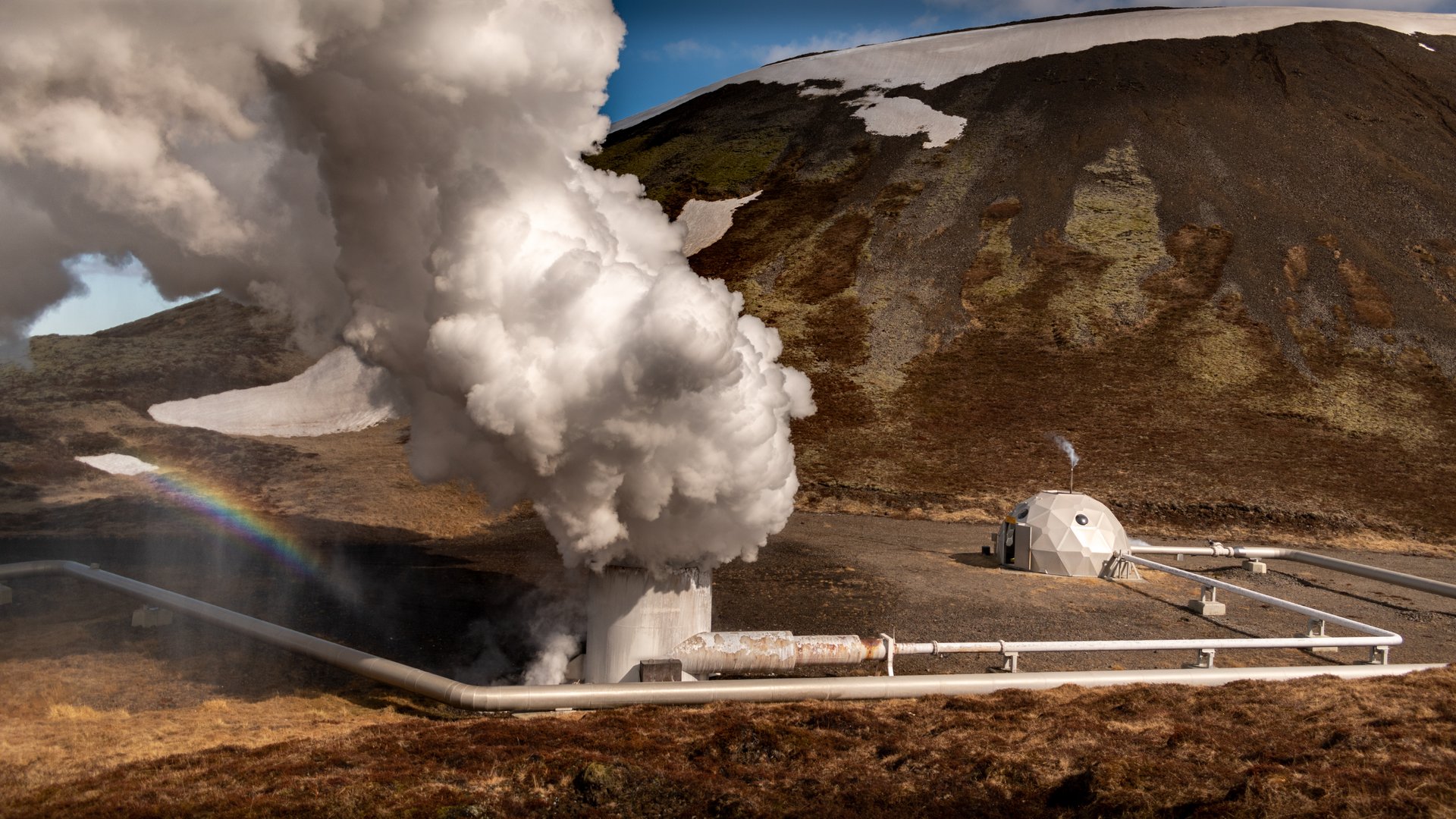
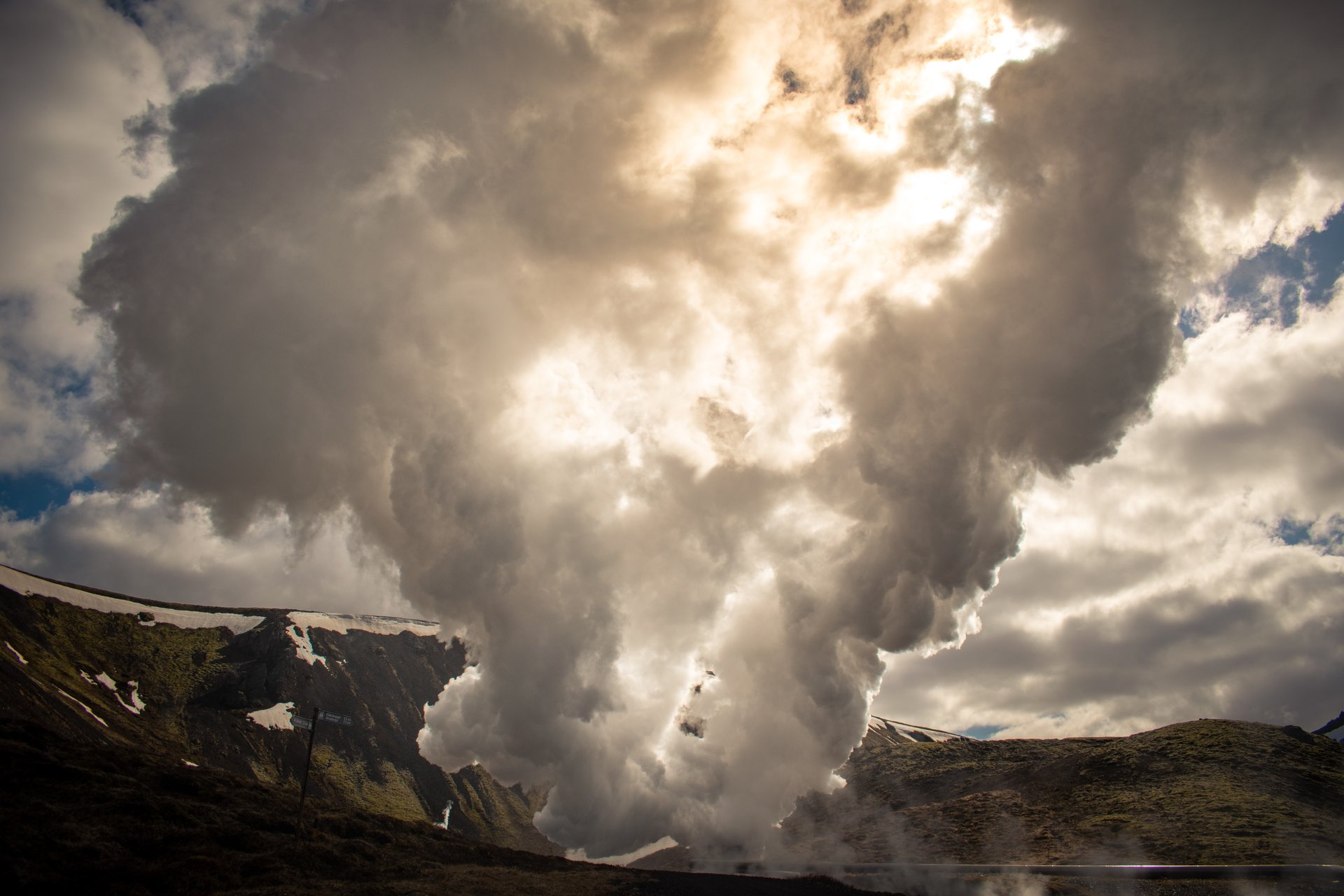
Reykjadalur means “Steam Valley,” and the name delivers. From the trailhead outside Hveragerði, you walk through a geothermally active landscape — steam vents hissing from the hillside, mud pools bubbling beside the path, and the faint smell of sulfur in the air. If you enjoy geothermal bathing experiences, this one is entirely natural.
The trail is a steady, gentle climb along a well-maintained gravel path. Nothing technical, and families with older children manage it comfortably. After roughly 3.5 kilometers, you reach the highlight: a section of the river where hot geothermal water mixes with cold stream water, creating a natural bathing spot in the middle of the valley.
Wooden walkways and basic changing screens line the riverbank. The temperature varies depending on where you sit — upstream is hotter, downstream is cooler. Finding your perfect spot is part of the fun. Bring a swimsuit and a towel, and budget at least 30 minutes for soaking.
What most visitors miss: The hike itself is beautiful, not just a means to reach the hot river. On the way up, take the small detour to the viewing platform overlooking the steaming hillside — the scale of the geothermal activity is impressive, and most people walk right past it.
Practical note: The trail gets muddy in spring and after rain. Waterproof hiking boots make a real difference here. As this is a very used path, staying on the marked trail is essential for nature preservation in the area.
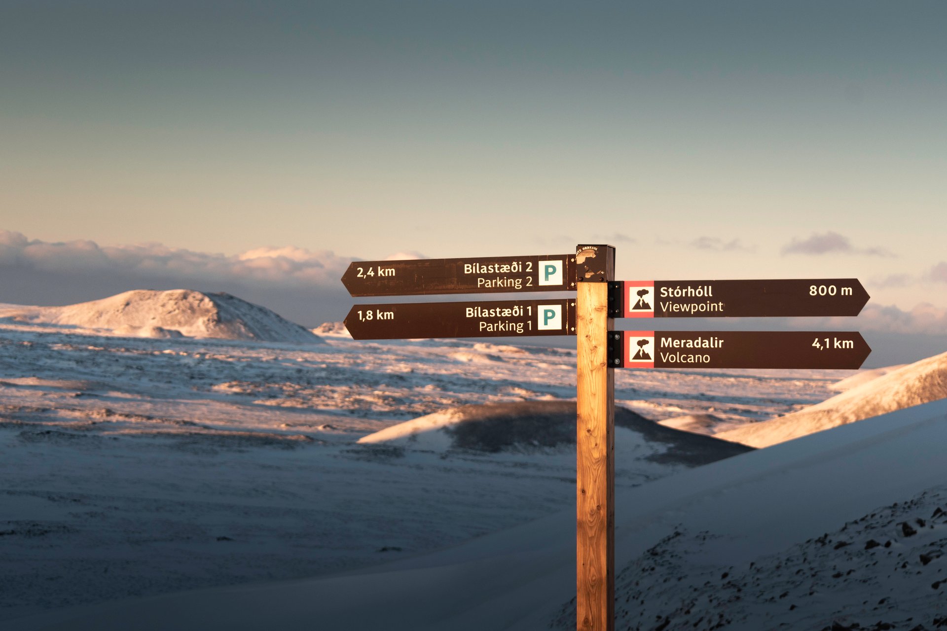
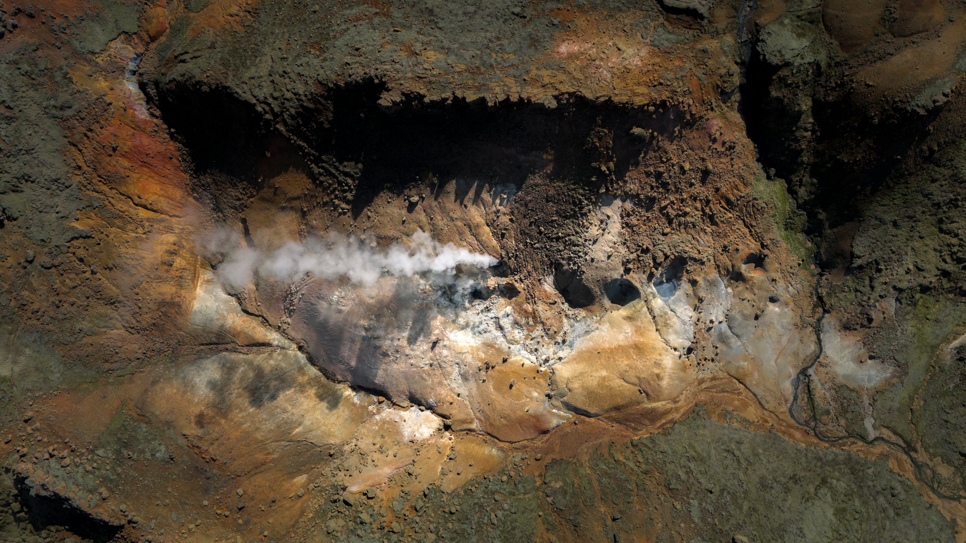
#3 — Fagradalsfjall Volcano: Walking on Earth’s Newest Land
Location: Reykjanes Peninsula, ~40 km southwest of Reykjavík (45-minute drive) Trail length: Variable, 6–10 km round trip depending on route Elevation gain: ~250–350 m Difficulty: Moderate Time: 3–5 hours Season: Year-round (check conditions in winter)
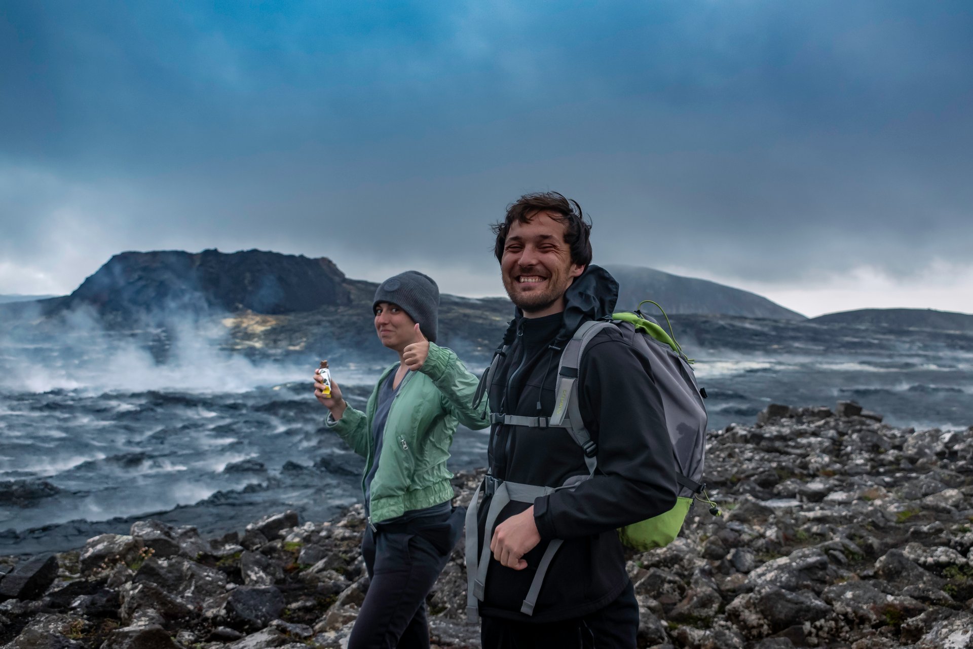
This is one of the most surreal hikes you can do anywhere in the world — less than an hour from downtown Reykjavík. The Fagradalsfjall volcanic system has been erupting on and off between 2021 and 2023, and the landscape it created is unlike anything else in Iceland. You walk across terrain that didn’t exist a few years ago — fresh lava fields in shades of black, rust, and copper, ranging from smooth, ropy formations to jagged, shattered blocks.
The trail from the parking area crosses older lava and climbs a ridge, eventually giving you a full view of the eruption craters and the vast lava fields spreading out below. Depending on the route, you may get quite close to recent formations. Some areas may still radiate heat.

We’ve taken clients here who have traveled all over the world, and they consistently say they’ve never seen anything like it.
Safety note: Always check the current status at safetravel.is before going. Stay on marked paths — the ground can be unstable and dangerously hot in some areas. For more context on the Reykjanes Peninsula and its volcanic landscape, check out our complete guide to Reykjanes.
Private tour advantage: We keep tabs on the trail conditions and know which vantage points deliver the best views.
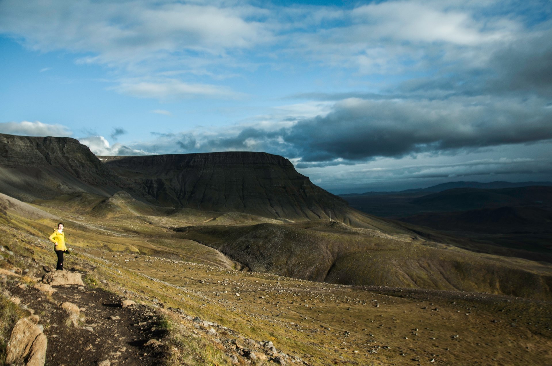
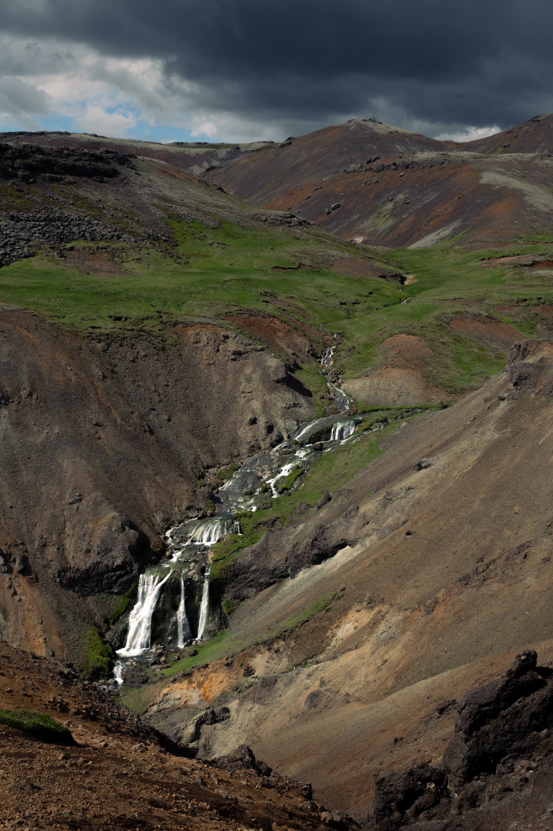
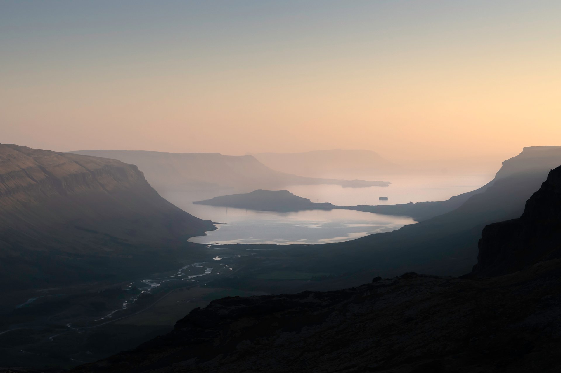
#2 — Hengill Educational Trail: Iceland’s Best-Kept Hiking Secret
Location: Nesjavellir area, ~35 km east of Reykjavík (35-minute drive) Trail length: ~7 km loop Elevation gain: ~200 m Difficulty: Easy to moderate Time: 2.5–3 hours Season: June–September
If we had to pick one hike that delivers the most “Iceland per kilometer,” it would be this one. And almost nobody knows about it.
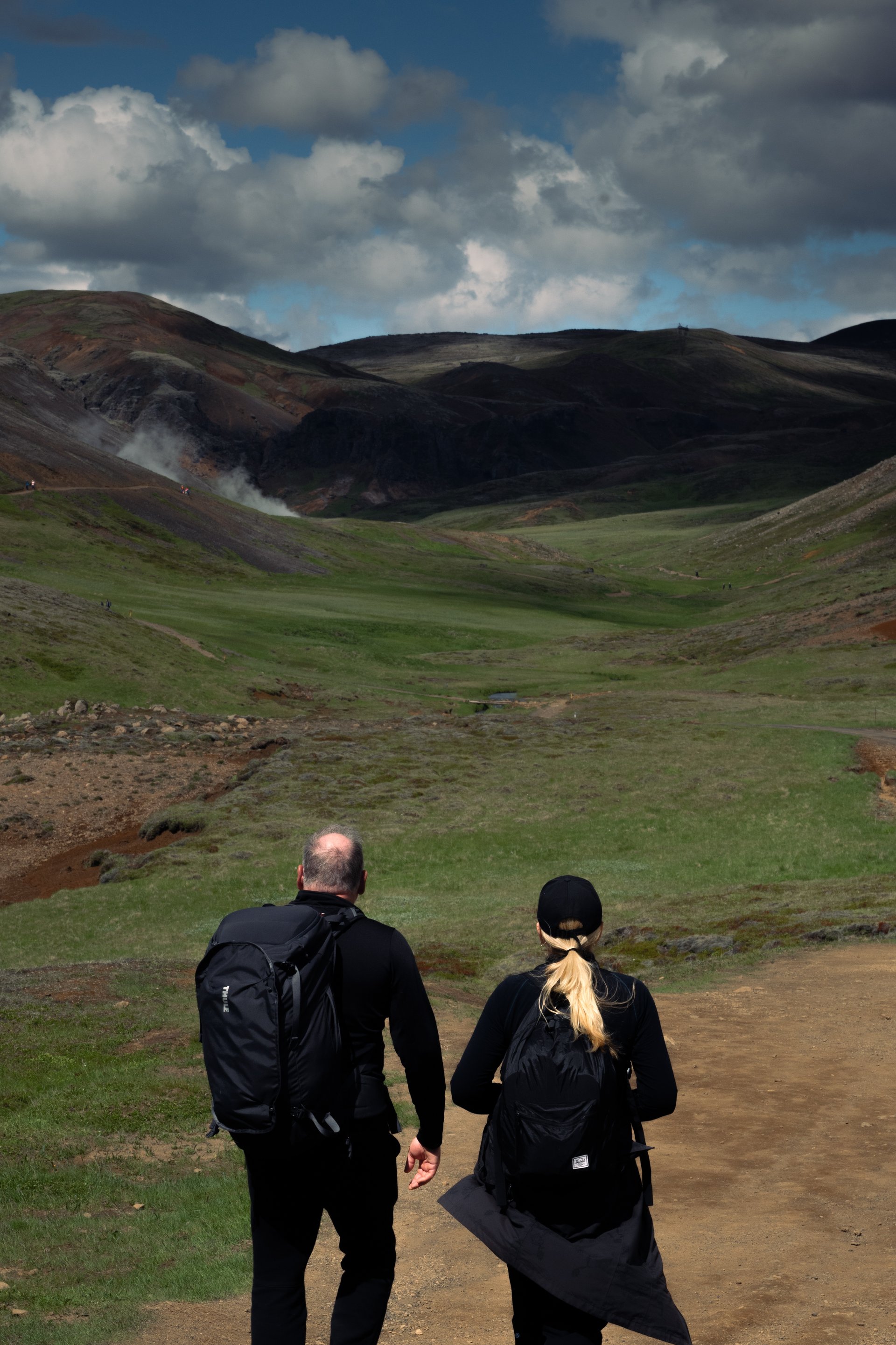
The Hengill Educational Trail (Fræðslustígur Hengils) is a loop starting near the Nesjavellir geothermal power plant. It passes through one of the most geothermally active areas in southwest Iceland, with numbered information posts explaining the geology, botany, and geothermal processes happening under your feet.
What makes this trail special is the concentration of landscapes packed into a short, easy hike. Within a couple of hours, you’ll walk through steaming fumaroles, past boiling mud pots, across bright green moss-covered lava, and along ridgelines with views over Þingvallavatn — Iceland’s largest natural lake and the tectonic rift that defines the country’s geological identity.
The educational aspect is genuinely well done. You learn why the ground changes color, what those steam vents actually are, and how the geothermal energy beneath your feet powers the hot water in Reykjavík’s taps.
And here’s the key: on a busy summer day when Þingvellir and Geysir are packed with tour buses, this trail — just as spectacular — might have a dozen people on it.
What we love about this hike: It’s the one we recommend to clients who want to understand Iceland, not just photograph it. The combination of visual spectacle and genuine education is rare, and the trail design is smart — every turn reveals something new.
Getting there: Drive toward Þingvellir but turn off toward Nesjavellir (road 435). The trailhead parking is near the power plant. Signage is minimal, which is partly why it stays quiet.
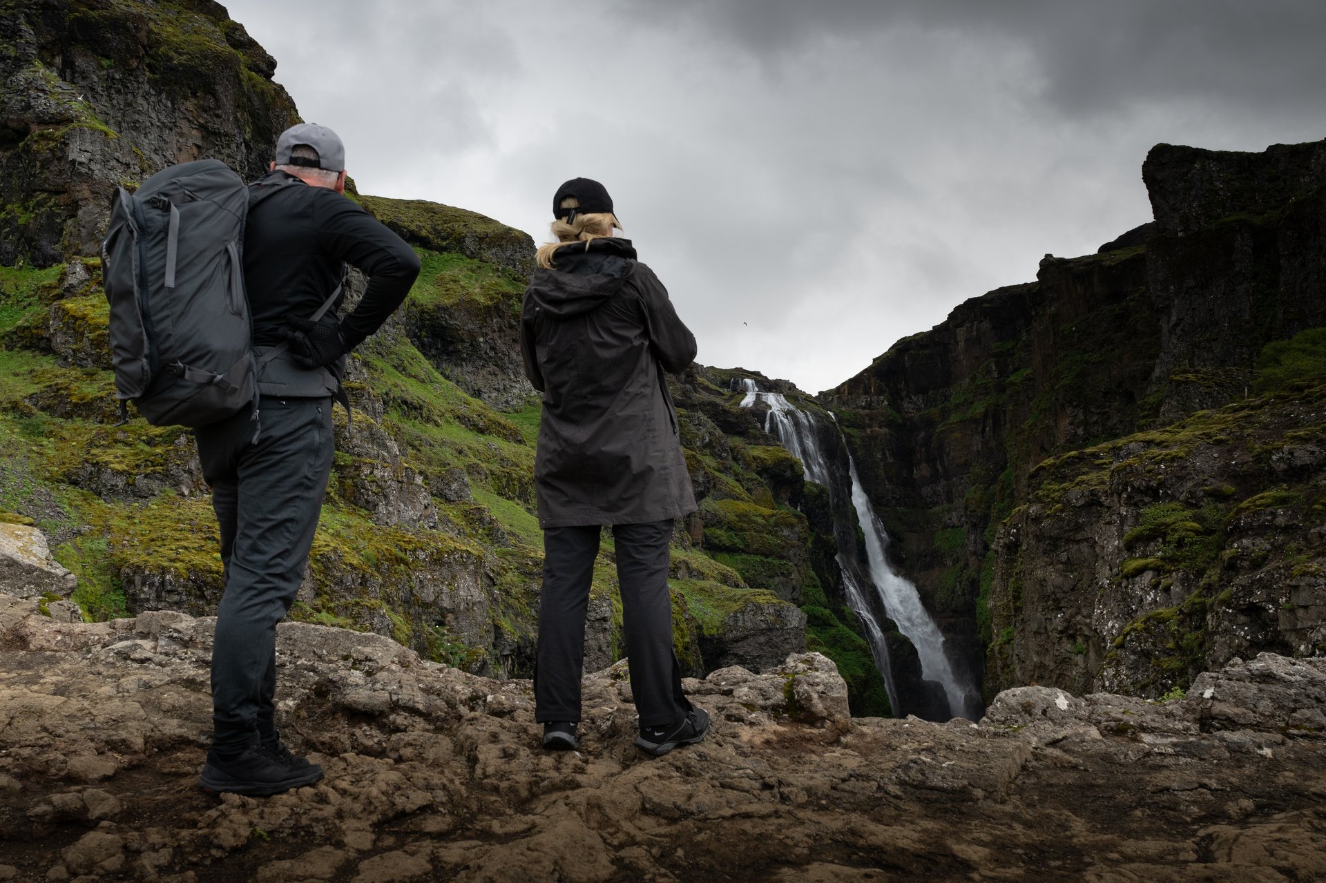
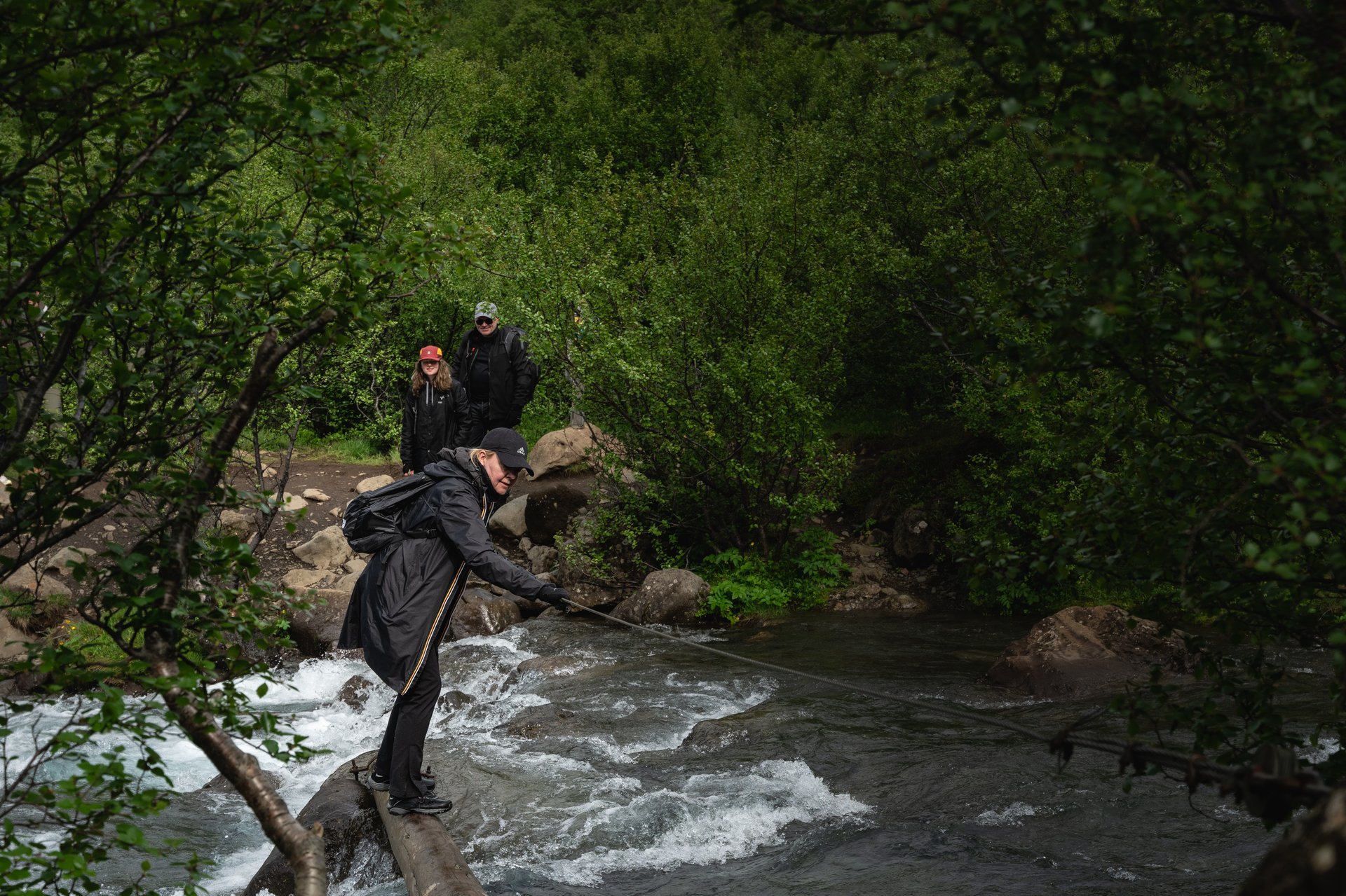
#1 — Glymur: Iceland’s Most Rewarding Waterfall Hike
Location: Hvalfjörður, ~65 km north of Reykjavík (50-minute drive) Trail length: ~7 km loop Elevation gain: ~400 m Difficulty: Challenging Time: 3.5–5 hours Season: June–September (river crossing required)
Glymur is the hike we save for clients who want to be challenged, surprised, and left speechless — ideally all in the same afternoon. We also offer it as a dedicated private day tour.
At 198 meters, Glymur held the title of Iceland’s tallest waterfall for decades (now technically second, after glacial retreat revealed Morsárfoss). But numbers don’t do it justice. What makes Glymur special is the full experience — the approach, the terrain, the river crossing, and the almost theatrical reveal of the falls as you round the final ridge.
The hike begins at the end of Hvalfjörður, a deep fjord most people bypass via the Hvalfjarðargöng tunnel. You start by walking through a small cave (bring a headlamp or use your phone light), then follow a trail climbing steeply through birch woodland along the Botnsá river canyon. The canyon gets deeper and more dramatic as you ascend, with progressively more impressive glimpses of the waterfall across the gorge.
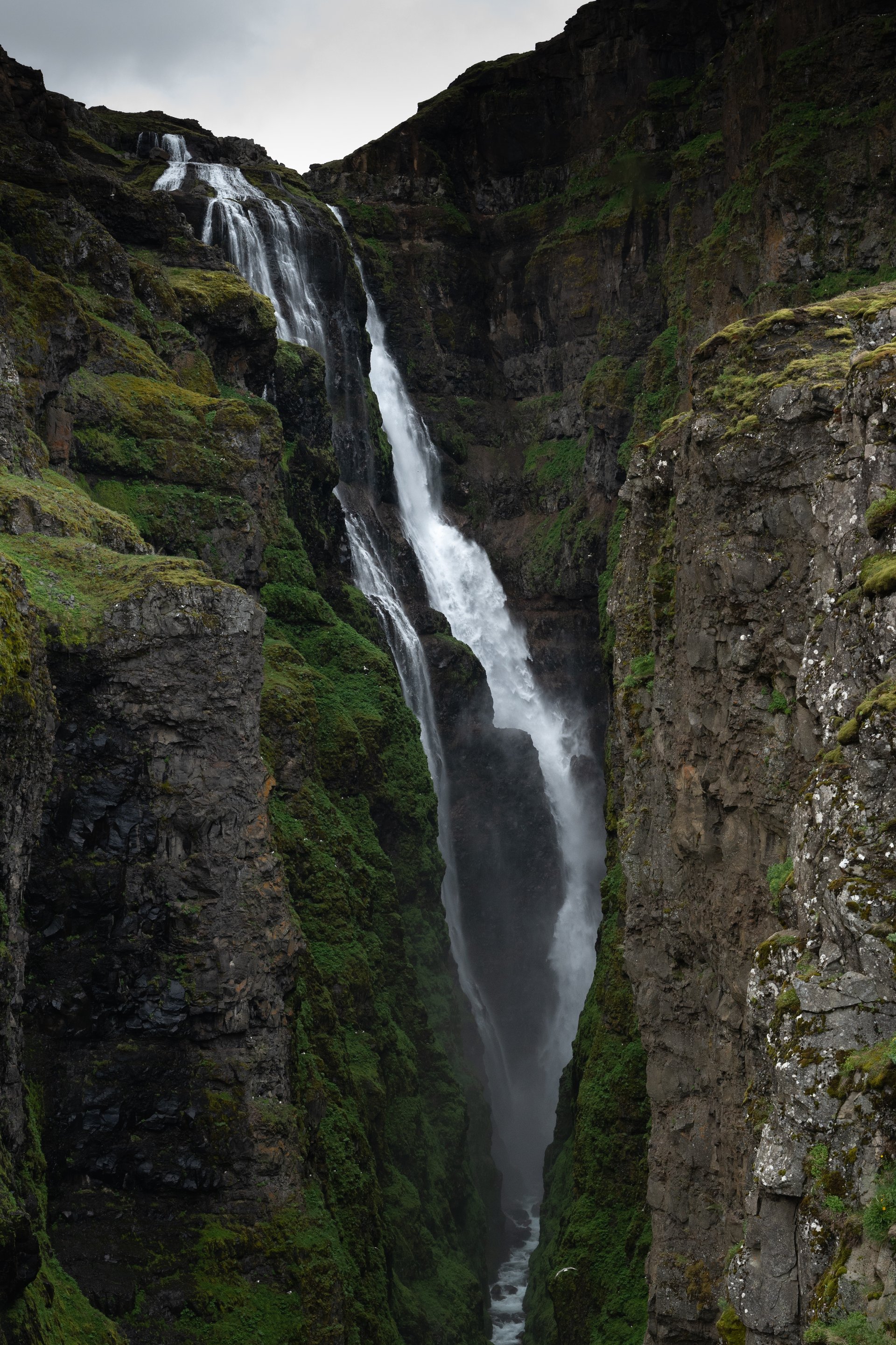
The trail is a loop — going counterclockwise (up the east side first) puts you at the best viewpoint at the top, where you look down into the canyon and see the full drop of the waterfall. That moment rewards every step.
The catch is the river crossing. Near the top of the loop, you need to ford the Botnsá river. In summer, the water is typically knee-deep and cold, but manageable with preparation. Bring sandals or water shoes and something to dry off with. In early summer or after heavy rain, the river can be higher and faster — use good judgment.
Why it’s number one: Glymur combines physical challenge, dramatic scenery, genuine adventure (the cave, the river crossing), and a payoff that matches any postcard-famous waterfall in Iceland — but with a fraction of the crowds. On most days, you’ll share the trail with a handful of other hikers, not hundreds.
Important: This is not a hike for flip-flops or cotton jeans. Proper waterproof hiking boots, layers, and river crossing footwear are essential. The trail is steep and exposed in places, and the weather in Hvalfjörður can differ significantly from conditions in Reykjavík.
How to Hike These Trails
All five hikes are doable as day trips from Reykjavík, and all trailheads are accessible by regular car on paved or good gravel roads. No 4x4 needed.
That said, these aren’t always straightforward — trail conditions change, weather in Iceland is unpredictable, and a wrong turn on Fagradalsfjall’s lava fields is a very different proposition than a wrong turn in a city park. If you’re considering renting a car, make sure you’re comfortable with Icelandic road conditions.
If you want to experience the best of these trails without the logistics, a private hiking day tour is the way to go. We’ve guided all of these trails countless times and can read conditions, adjust the plan, and take you to the viewpoints and timing that make each hike stand out. You get picked up from your accommodation, we handle everything, and you focus entirely on the experience.
See our private day tours or contact us to design a hiking day built around your group.
FAQ
What is the best hike near Reykjavík for beginners? Reykjadalur is the most accessible option — well-maintained trail, gentle grade, and the hot river at the end is a strong motivator. The Hengill Educational Trail is also excellent for less experienced hikers and offers more variety.
Can I do these hikes in winter? Fagradalsfjall and Reykjadalur are accessible year-round, though winter conditions require proper gear (crampons, layers, headlamp for shorter daylight). Glymur should absolutely not be done in winter. Esja can only be done during dry winters, do not attempt it when snow covered (risk of avalanche).
Do I need a guide for these hikes? None of these trails strictly require a guide in good conditions. However, conditions in Iceland change fast — what looks like a clear day can shift within an hour. A local guide adds safety, context, and knowledge of the best routes and timing.
How do I combine multiple hikes in one day? Esja and Glymur are both north of Reykjavík and could theoretically be combined, but that’s a very long day. A more comfortable pairing is Hengill + Reykjadalur, since they’re in the same direction. On a private tour, we can design a full hiking day that makes the most of your time and energy.
What should I bring? Waterproof hiking boots (not trail runners), layered clothing including a wind/rain shell, water, snacks, and a swimsuit if you’re doing Reykjadalur. For Glymur, add river crossing shoes. Sunglasses and sunscreen in summer.
More Pictures
#5: Mount Esja
#4: Reykjadalur
#3: Fagradalsfjall

#2: Hengill Educational Trail
#1: Glymur