Since 2021, there has been important volcanic unrest on the Reykjanes Peninsula. This new volcanic cycle started as something relatively harmless, but starting from the fourth eruption it created massive damage to inhabited areas, which sadly led to the evacuation of the charming town of Grindavík. Understanding this recent volcanic history helps contextualize what you might encounter when visiting the Reykjanes Peninsula and provides insight into Iceland’s dynamic geological nature.
The Volcanic Situation on Reykjanes Peninsula
Five Volcanic Systems on a Tiny Region
The Reykjanes Peninsula packs an exceptional concentration of volcanic power into a relatively small area. Five distinct volcanic systems converge here: Reykjanes, Svartsengi, Fagradalsfjall, Krýsuvík, and Brennisteinsfjöll. Each system has its own network of fissures, craters, and underground magma pathways.
What makes this concentration remarkable is the peninsula’s position straddling the Mid-Atlantic Ridge, the boundary where the North American and Eurasian tectonic plates pull apart at roughly 2 centimeters per year. This geological setting creates the perfect conditions for volcanic activity, with magma rising to fill the gap as the plates separate.
The volcanic systems don’t operate independently. They’re interconnected through a complex network of underground pathways, meaning activity in one system can influence another. Scientists monitor all five systems simultaneously because an eruption in any location provides valuable data about the entire peninsula’s volcanic behavior.
The Youngest Region in Iceland
Geologically speaking, the Reykjanes Peninsula is Iceland’s infant. While other parts of Iceland formed millions of years ago as the island gradually built itself through volcanic eruptions, most of the Reykjanes Peninsula’s landscape is much younger with some areas just a few months old as we write this article!
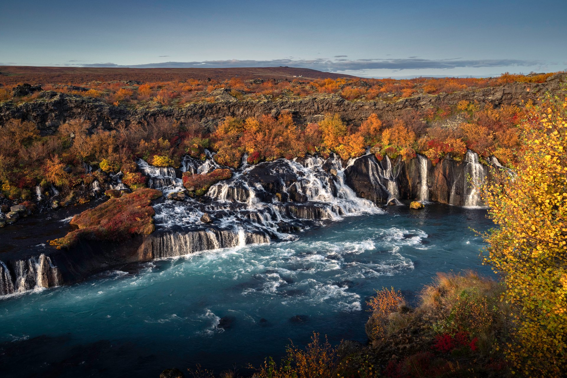
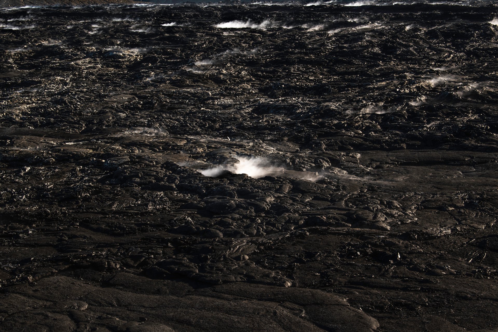
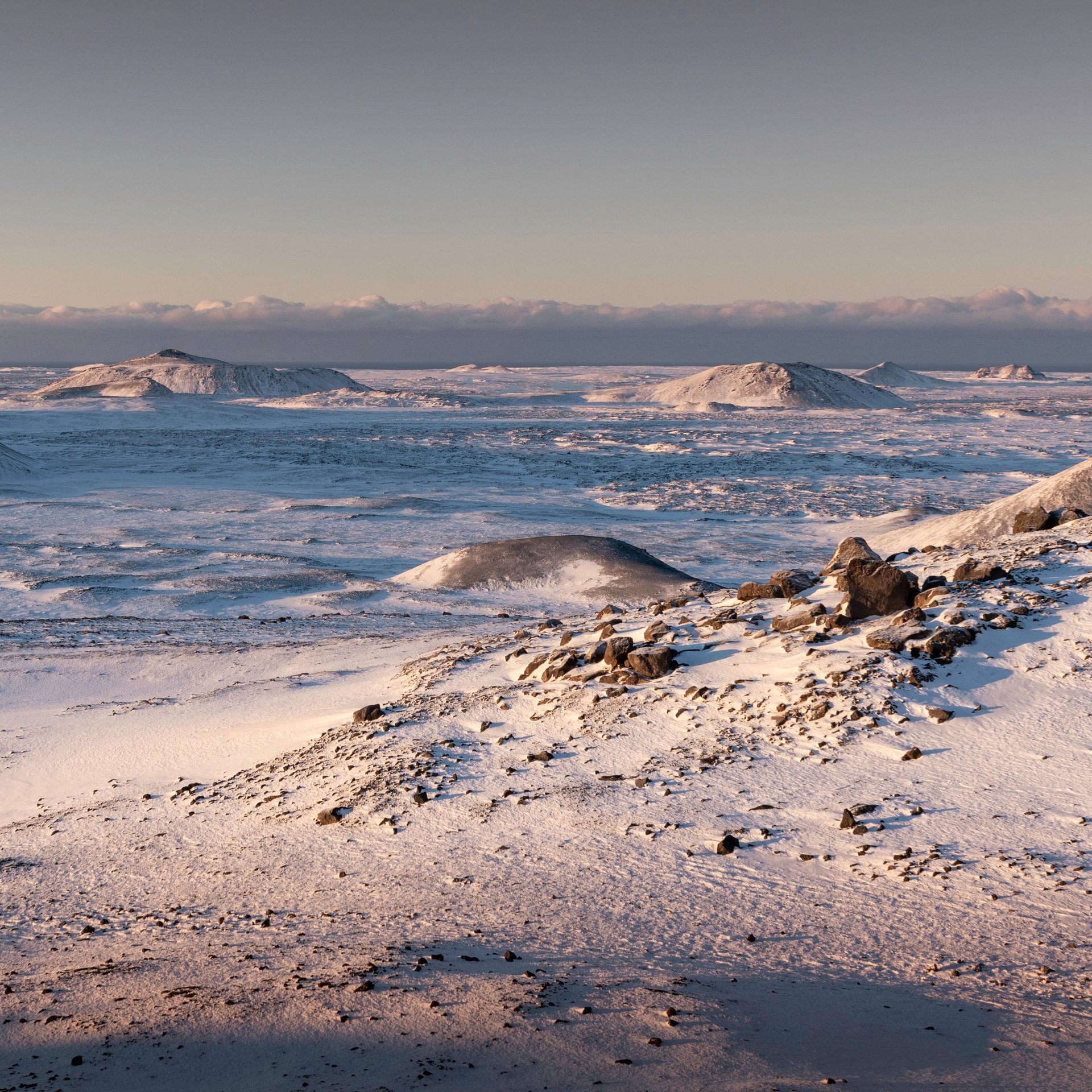
This youth explains the peninsula’s stark, otherworldly appearance. You won’t find so much of the thick moss coverage or established vegetation common elsewhere in Iceland. Instead, the landscape consists of fresh volcanic rock, geothermal fields, and terrain that looks almost Martian in places. The sparse vegetation and exposed geology make it easier to read the volcanic history written in the rocks.
The peninsula experiences volcanic activity in cycles. Historical records and geological evidence suggest these cycles last for centuries, with eruptions occurring regularly for a period, followed by centuries of quiet. The last major volcanic episode ran from roughly 1210 to 1240 CE, producing multiple eruptions across the region. After that, the peninsula went dormant for about 800 years until 2021.
Scientists had been detecting increasing seismic activity beneath the peninsula since 2019, with thousands of small earthquakes indicating magma movement underground. This seismic unrest signaled that the peninsula was waking up, transitioning from its long dormancy into a new volcanic period expected to last decades or even centuries.
The Eruptions of Fagradalsfjall: 2021-2023
March 19, 2021: Geldingadalir
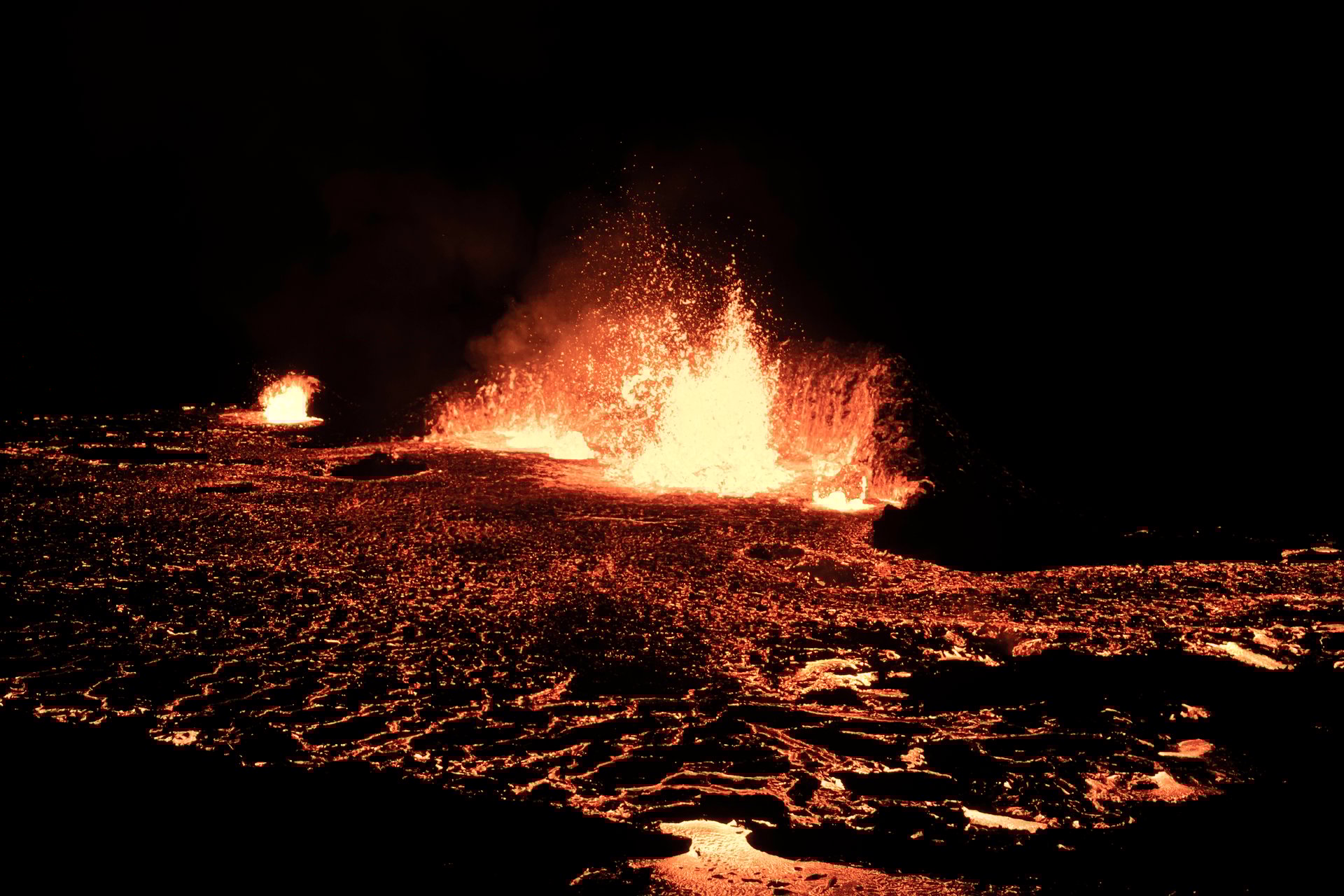
The Reykjanes Peninsula’s volcanic awakening began on March 19, 2021, in Geldingadalir valley. After years of mounting seismic activity, lava finally broke through the surface, marking the first eruption on the peninsula in over 800 years.
This eruption defied typical expectations. Instead of a violent explosion, it produced a steady, effusive flow of lava that fountained from the ground in mesmerizing displays. The location proved perfect: far from populated areas, accessible by hiking trails, and spectacular enough to draw international attention.
For six months, the eruption continued with varying intensity. Some days brought towering lava fountains shooting 50 meters into the air. Other periods showed gentler flows, with molten rock streaming across the valley floor. The lava field grew steadily, eventually covering 4.8 square kilometers and reaching depths of up to 50 meters in places.
The eruption attracted an estimated 700,000 visitors during its active period, making it one of the most-visited natural events in Iceland’s history. People hiked for hours across rough volcanic terrain to stand within safe viewing distance of active lava fountains. Night visits proved especially popular, when the orange glow illuminated the entire valley.
Scientists seized the opportunity to study the eruption up close, deploying sensors, collecting lava samples, and monitoring gas emissions. The data gathered proved invaluable for understanding how Reykjanes volcanic systems behave after centuries of dormancy.
The eruption officially ended in September 2021, leaving behind a transformed landscape of black volcanic rock, cooling lava fields, and new topography that hadn’t existed six months earlier.
2022: Meradalir
Almost exactly one year after the 2021 eruption ended, the Fagradalsfjall volcanic system reactivated. On August 3, 2022, lava began erupting in Meradalir valley, located adjacent to the 2021 eruption site.
This second eruption showed different characteristics from its predecessor. While the 2021 event lasted six months, the 2022 eruption compressed its activity into just three weeks of intense volcanic output. The lava fountains reached impressive heights, and the flow rates exceeded what scientists observed in 2021.
The condensed timeline created urgency for visitors. Unlike 2021, when people had months to plan their visit, this eruption required immediate action. Those who wanted to witness active lava needed to monitor daily reports and be ready to hike on short notice.
Despite the brief duration, the eruption added approximately 0.9 square kilometers of fresh lava to the landscape. The molten rock filled Meradalir valley and connected with some of the 2021 lava field, creating a larger continuous volcanic landscape.
Scientists noted that the rapid succession of eruptions suggested the volcanic system remained highly active, with magma readily available beneath the surface. The pattern indicated this wasn’t isolated volcanic activity but rather the beginning of a sustained volcanic period.
2023: Litli-Hrútur
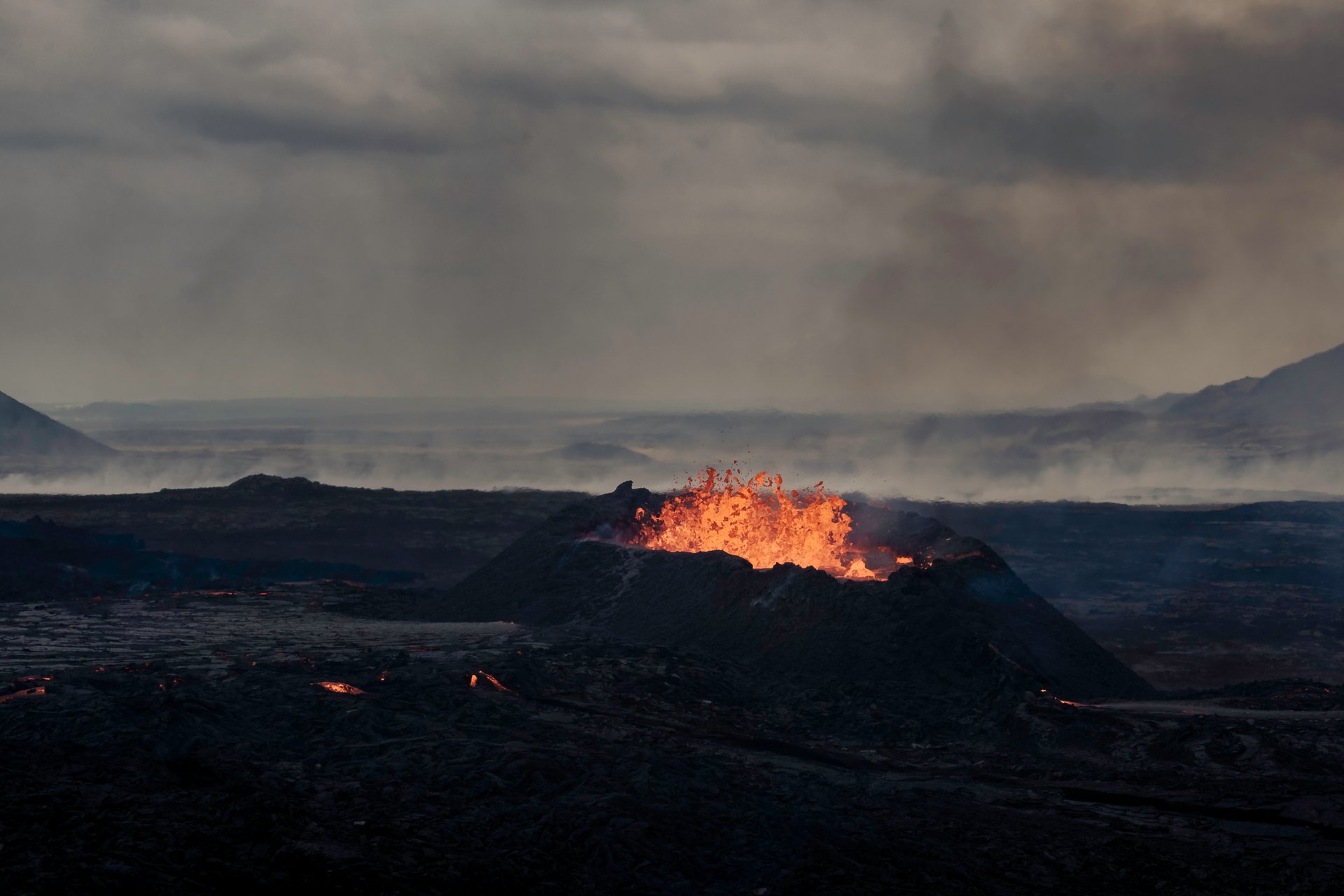
The third eruption in the Fagradalsfjall series began on July 10, 2023, at Litli-Hrútur (meaning “Little Ram”). Once again, lava broke through near the previous eruption sites, demonstrating the volcanic system’s focus on this particular area.
Litli-Hrútur followed a similar pattern to Meradalir: brief but intense. The eruption lasted approximately one month before shutting down in early August 2023. Lava fountains illuminated the night sky, and fresh volcanic terrain formed rapidly as molten rock spread across the landscape.
By this point, the pattern had become clear. The Fagradalsfjall volcanic system was producing regular eruptions, each accessible to visitors willing to make the hike. The proximity of all three sites created an expanding volcanic field where you could walk across lava from 2021, 2022, and 2023 in a single hike.
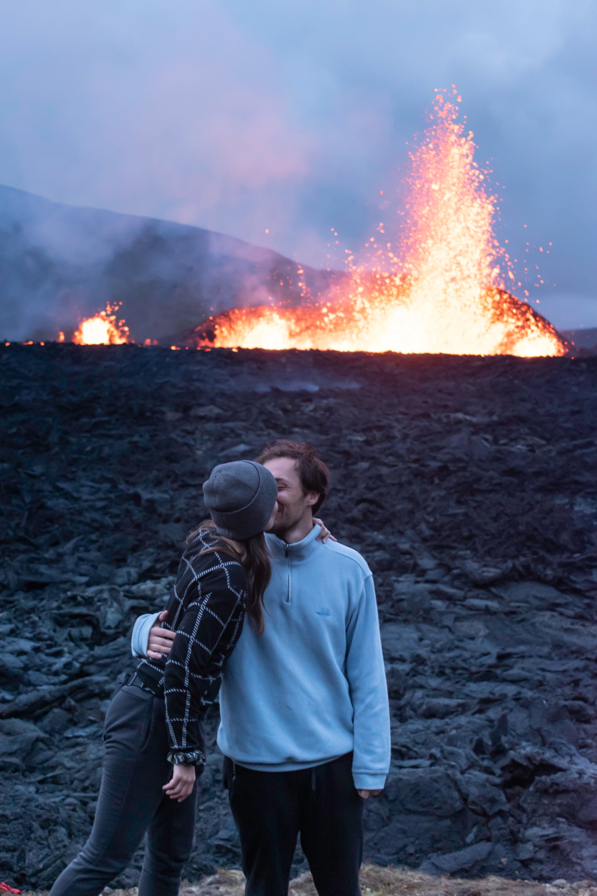
However, while these three eruptions earned the nickname “tourist eruptions” for their accessibility and relative safety, the volcanic situation was about to change dramatically. The next phase would pose genuine threats to infrastructure and communities. You can see photographs from all these eruptions in our dedicated visual gallery.
The Eruptions of Sundhnúksgígar Since 2024

The Shift to Grindavík
In late 2023, seismic activity began concentrating north of Grindavík, a fishing town of 3,800 residents on the peninsula’s south coast. On November 10, 2023, intense earthquake swarms began, with thousands of tremors detected in a matter of days. Ground deformation measurements showed a magma dike forcing its way beneath the town.
Authorities ordered the complete evacuation of Grindavík on November 11, 2023. Residents had hours to gather essentials and leave their homes, not knowing if or when they could return. The town stood empty as scientists monitored the underground magma movement.
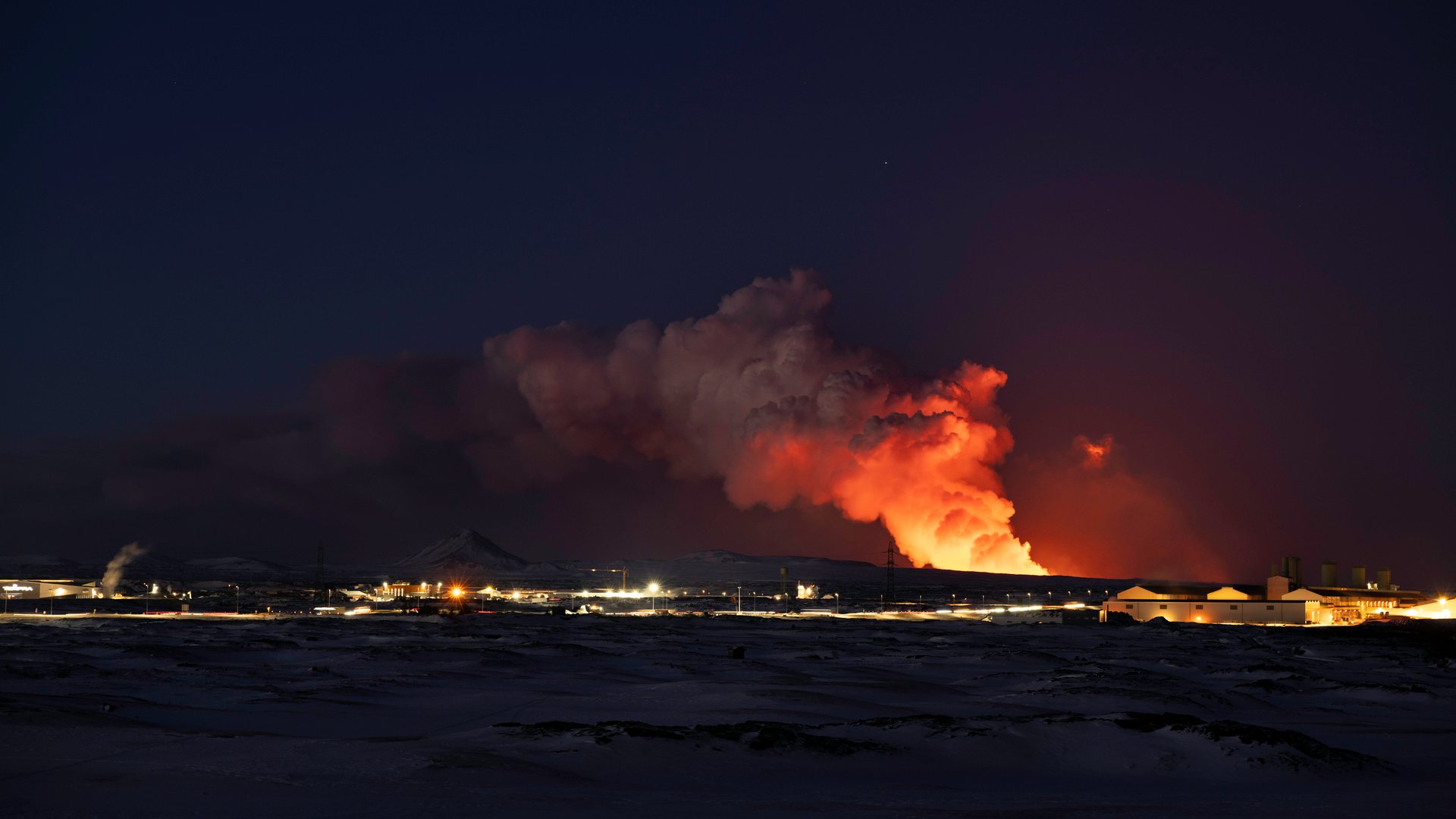
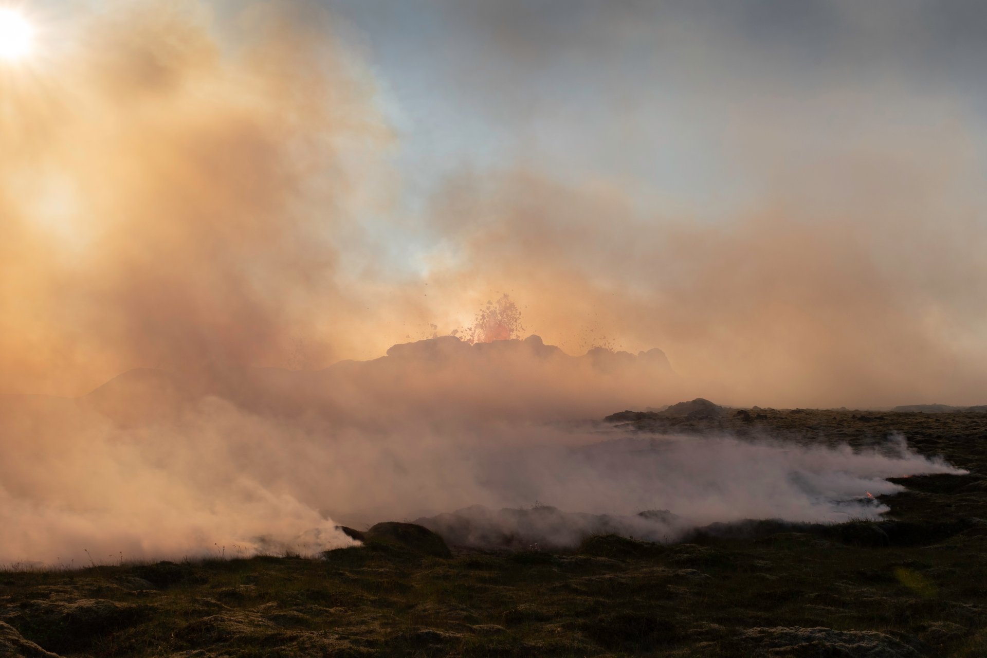
The first eruption from the Sundhnúksgígar crater row began on December 18, 2023. Unlike the previous Fagradalsfjall eruptions in remote valleys, this one erupted dangerously close to Grindavík and critical infrastructure including the Svartsengi geothermal power plant and the famous Blue Lagoon spa.
The Eruption Sequence
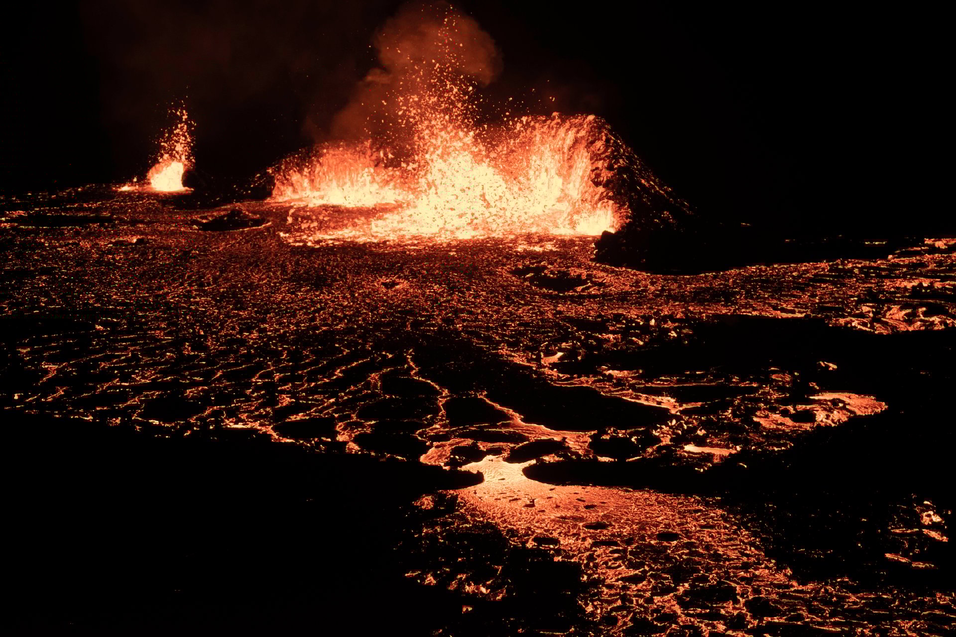
From December 2023 through August 2025, the Sundhnúksgígar system produced nine separate eruptions. Each posed different threats and challenges:
Eruption 1 (December 18, 2023): The initial eruption opened a 4-kilometer fissure north of Grindavík. Lava flowed but didn’t reach the town.
Eruption 2 (January 14, 2024): Lava entered Grindavík for the first time, destroying three homes and damaging infrastructure before emergency barriers helped redirect the flow.
Eruption 3 (February 8, 2024): Another brief eruption threatened the town and the Svartsengi power plant. Engineering teams worked around the clock building massive earth barriers.
Eruption 4 (March 16, 2024): Lava flows cut the main road between Grindavík and the nearby geothermal area, forcing infrastructure rerouting.
Eruption 5 (May 29, 2024): This eruption damaged the Blue Lagoon parking lot and forced the iconic spa to close temporarily while protective measures were implemented.
Eruption 6 (August 22, 2024): Another close call for Grindavík, with lava flows approaching but ultimately being diverted by defensive barriers.
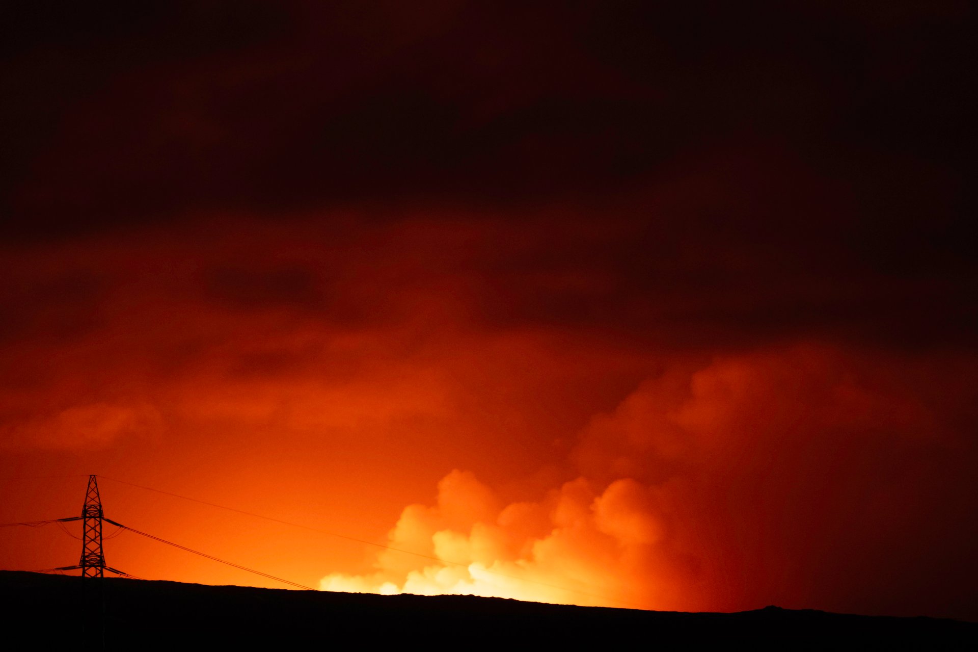
Eruption 7 (November 20, 2024): Overnight eruption that again threatened both Grindavík and Svartsengi, requiring emergency response.
Eruption 8 (February 2025): Shorter duration but high intensity, testing the defensive infrastructure built around vulnerable areas.
Eruption 9 (July 16 - August 5, 2025): The most recent eruption lasted 20 days, once again demonstrating that the volcanic activity shows no signs of stopping.
Impact on Grindavík and Infrastructure
The repeated evacuations devastated Grindavík’s community. Residents lived in uncertainty, never knowing when the next eruption would occur or whether their homes would survive. Many chose not to return, even during quiet periods, leading to a gradual depopulation of this historic fishing village.
Massive engineering efforts protected critical infrastructure. Workers constructed enormous earth barriers, sometimes reaching heights of 10-15 meters, designed to redirect lava flows away from the Svartsengi power plant. The plant supplies electricity and hot water to thousands of residents across the peninsula, making its protection essential.
The Blue Lagoon, one of Iceland’s most visited tourist attractions, faced repeated closures. Each eruption required evacuation and temporary shutdown while authorities assessed the risk. Despite these challenges, the facility adapted with improved monitoring systems and evacuation procedures.
Road networks suffered significant damage. Lava flows cut Highway 427, the main road connecting Grindavík to other parts of the peninsula. Engineers rerouted infrastructure and reinforced vulnerable sections, but each new eruption posed fresh challenges.
Unlike the 2021-2023 eruptions, authorities did not open these eruption sites to public ground access (except the one in summer 2025). The proximity to populated areas, unpredictable nature of the activity, and rapid onset made ground viewing too dangerous. Helicopter tours provided the only way for visitors to witness these eruptions up close. Learn more about how to see lava in Iceland with current volcanic activity.
Visit the Reykjanes Peninsula and the Eruption Sites
A Private Tour to Reykjanes
Exploring the Reykjanes Peninsula with a private tour offers the flexibility to focus on what interests you most while ensuring you get expert interpretation of the volcanic landscapes. Our Colors of Reykjanes private tour takes you across the peninsula’s diverse volcanic terrain, from steaming geothermal areas to dramatic coastal cliffs.
A private guide provides context that transforms the landscape from interesting to extraordinary. They’ll explain how specific lava formations developed, point out evidence of historical eruptions, and help you understand the geological forces that continue reshaping this region. You can ask questions, spend extra time at locations that fascinate you, and adjust the itinerary based on current conditions and your interests.
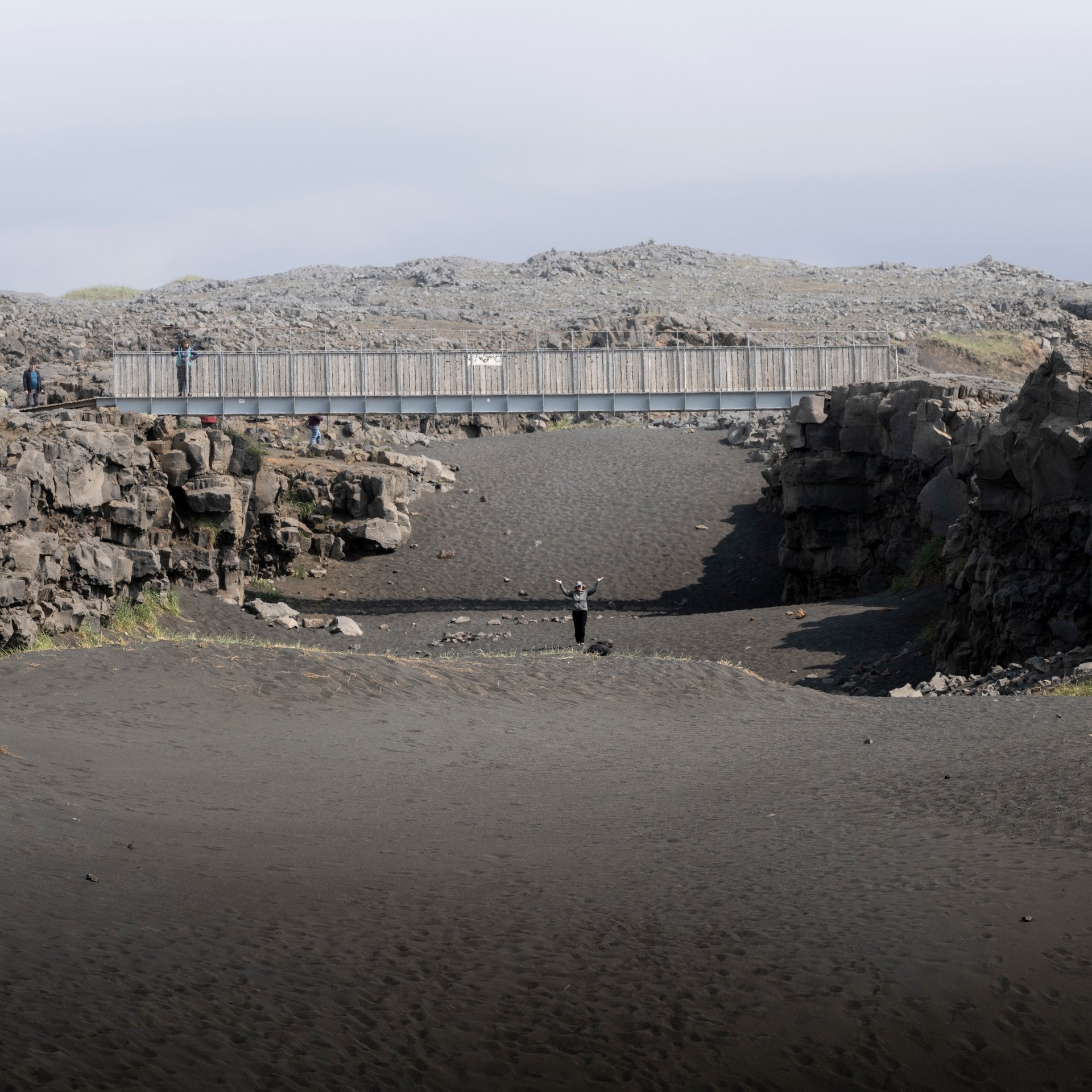
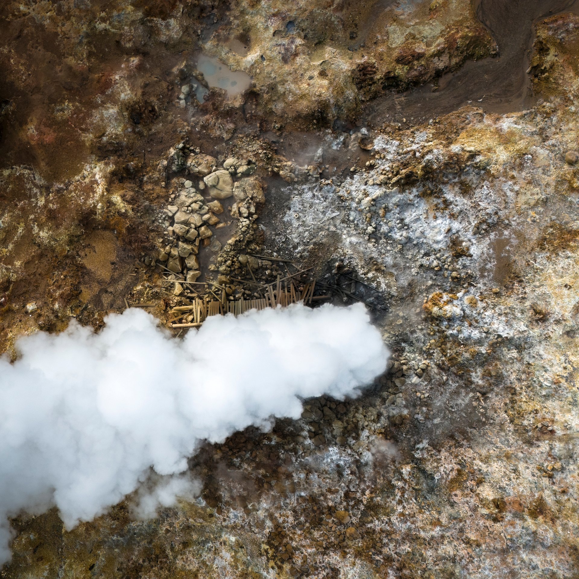
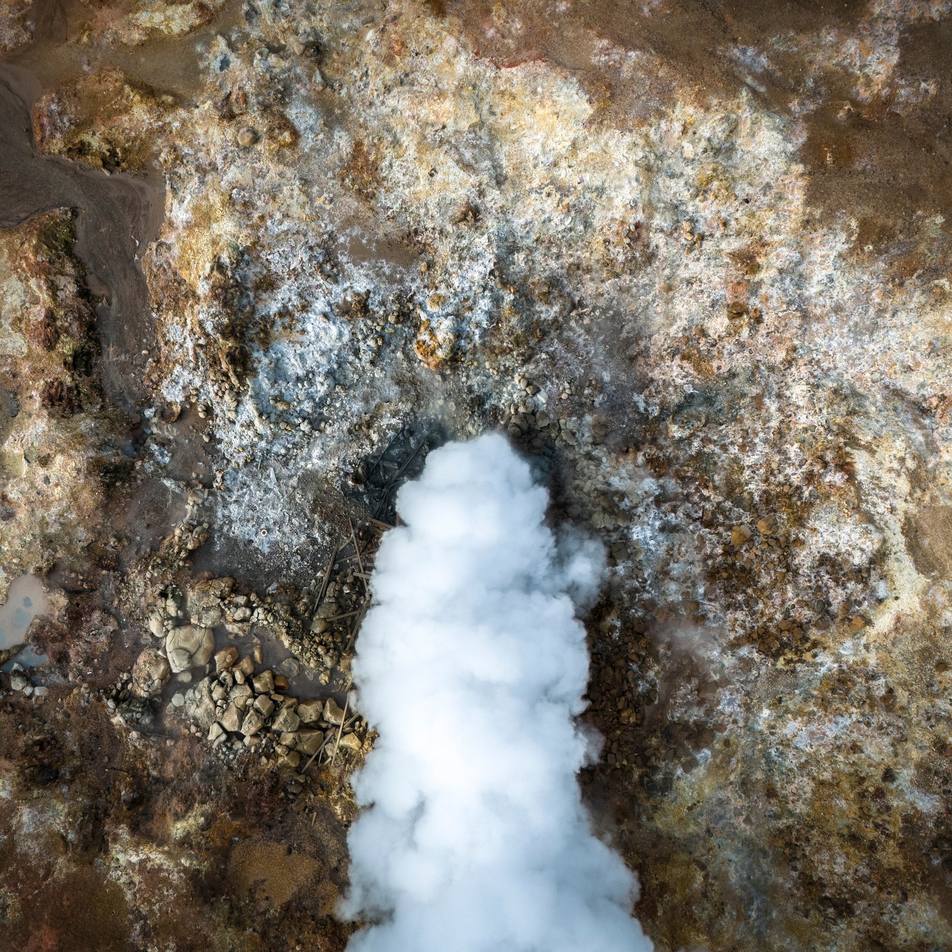
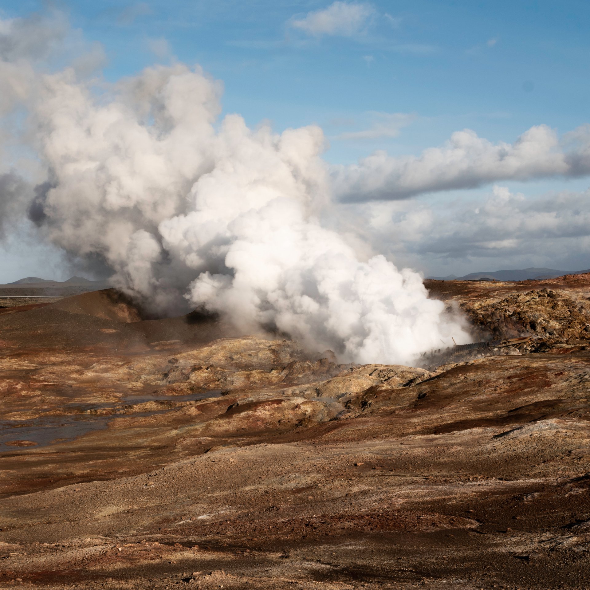
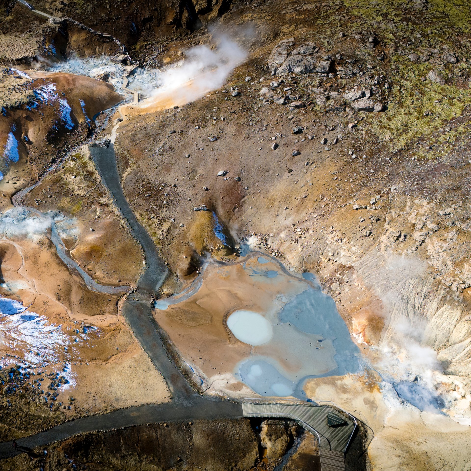
The peninsula offers far more than just recent eruption sites. You’ll encounter bubbling mud pools at Gunnuhver, one of Iceland’s most powerful geothermal areas. The Bridge Between Continents lets you walk between the North American and Eurasian tectonic plates. Coastal areas feature dramatic sea cliffs, lighthouses, and black sand beaches where the Atlantic crashes against fresh volcanic rock.
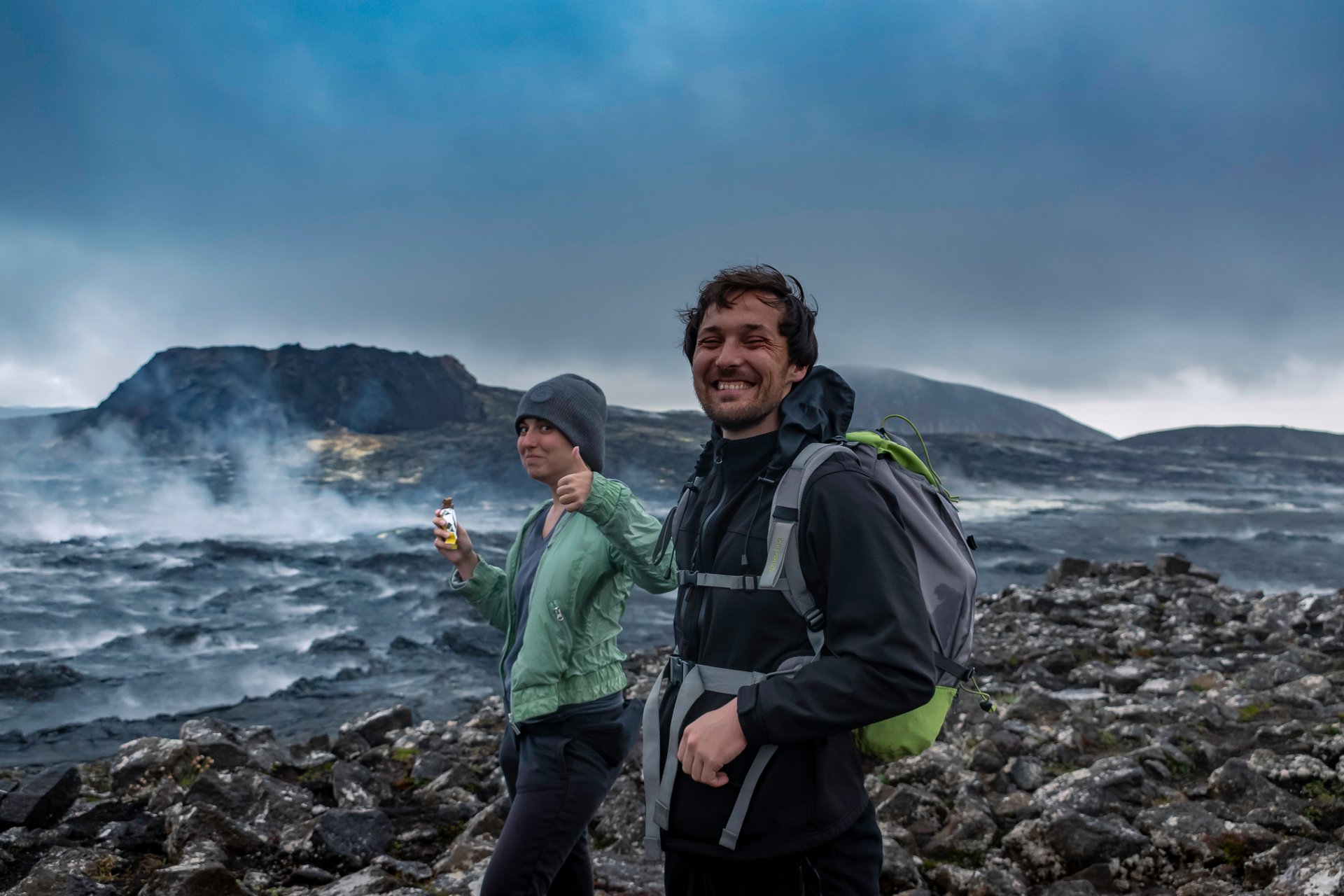
Private tours can access the cooled lava fields from the 2021-2023 eruptions, where you can walk next to terrain that didn’t exist a few years ago. The black volcanic rock shows patterns created as the lava cooled, with some areas displaying smooth ropy textures while others formed sharp, jagged surfaces.
Small Group Tours to the Peninsula
If you prefer sharing the experience with other travelers while keeping costs lower, small group tours provide excellent value. These tours follow set itineraries covering the peninsula’s highlights, ensuring you don’t miss key volcanic features and geothermal areas.
Small group settings often enhance the experience through shared wonder and diverse perspectives. Fellow travelers might notice details you missed, ask questions that spark interesting discussions, and create a sense of camaraderie as you explore together.
Do not hesitate to contact us to plan your Reykjanes adventure!